Murghab/Мургаб River, Tajikistan 2023
In August of 2023, for our annual vacation-adventure thing we decided to go to Tajikistan. Initially we’d planned to head to Baffin Island, but trying to get there from the Faroe Islands was non-trivial and we didn’t really know how to deal with polar bears. We’d also really liked Kyrgyzstan last time we were there, so we were very excited to go.
Plan
We didn’t really have any idea what we’d be doing in the country until a few weeks ahead of time- I’d had a bunch of rivers I wanted to do, but we only really had packrafts and that was about it. Somehow, eventually, we were tipped off to the Murghab River. Megan was a little iffy about paddling anything Class IVish, and this looked relatively doable, so we decided to try it.
A few russian teams have descended the river (here is a good trip report) but otherwise it’s kind of unknown. A team of kayakers have also descended it, which gave us some good english beta. For the most part, we didn’t really know what we’d be in for: Probably lots of terrible lake miles, some way-too-big-class-V+ that we’d have to portage, high elevation, and a lot of beautiful scenery. Perfect.
We finally settled on a plan to paddle the river, cross Lake Sarez to the Irkht Valley and hike out to the town of Bachor. What could go wrong?
Pamir Trips was instrumental in helping us figure out a lot of the logistics. Sharaf was very helpful and responsive.
A New Lake?
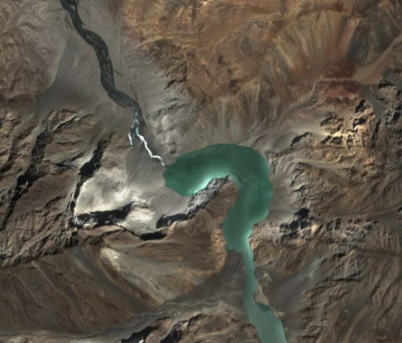
I was doing some route-scoping on SentinelHub (Thanks Luc!) and stumbled upon a new lake recently formed on our route, right where all of the really difficult whitewater was supposed to be. Apparently an earthquake in February 2023 had triggered a landslide along the river, blocking it and damming it, not unlike Lake Sarez itself. I was able to watch via the sattelite imaggery as the lake slowly filled, then partially released as it broke through the top of the rubble.
This added a new complication: Parties before us had some rather exciting and difficult portages along this section, and we had no idea how the landslide would look once we got there. Would we be able to get over it? Would the currents force us to stay far away? Could we come up with a plan B?
We decided to go for it anyway, with a rather awful escape plan to get up and out of the lake if we couldn’t scale the landslide. I was optimistic, Megan less so. We made a large note of this in our trip plan document as a possible snag.
Day 0
I’ll skip a lot of the standard “We lived in a Land Cruiser for a week driving to Murghab along the Pamir Highway” stuff since this is more of a trip report and just get right to the day before we started. We, our food, all of our gear, and our optimism made it intact to the town of Murghab, sitting at a cool 12,000 feet.
I had some altitude sickness just as we got into town and spent the rest of the afternoon and evening in bed half asleep, but Megan managed to make some friends with a WHO crew that was up there and had a more entertaining night.
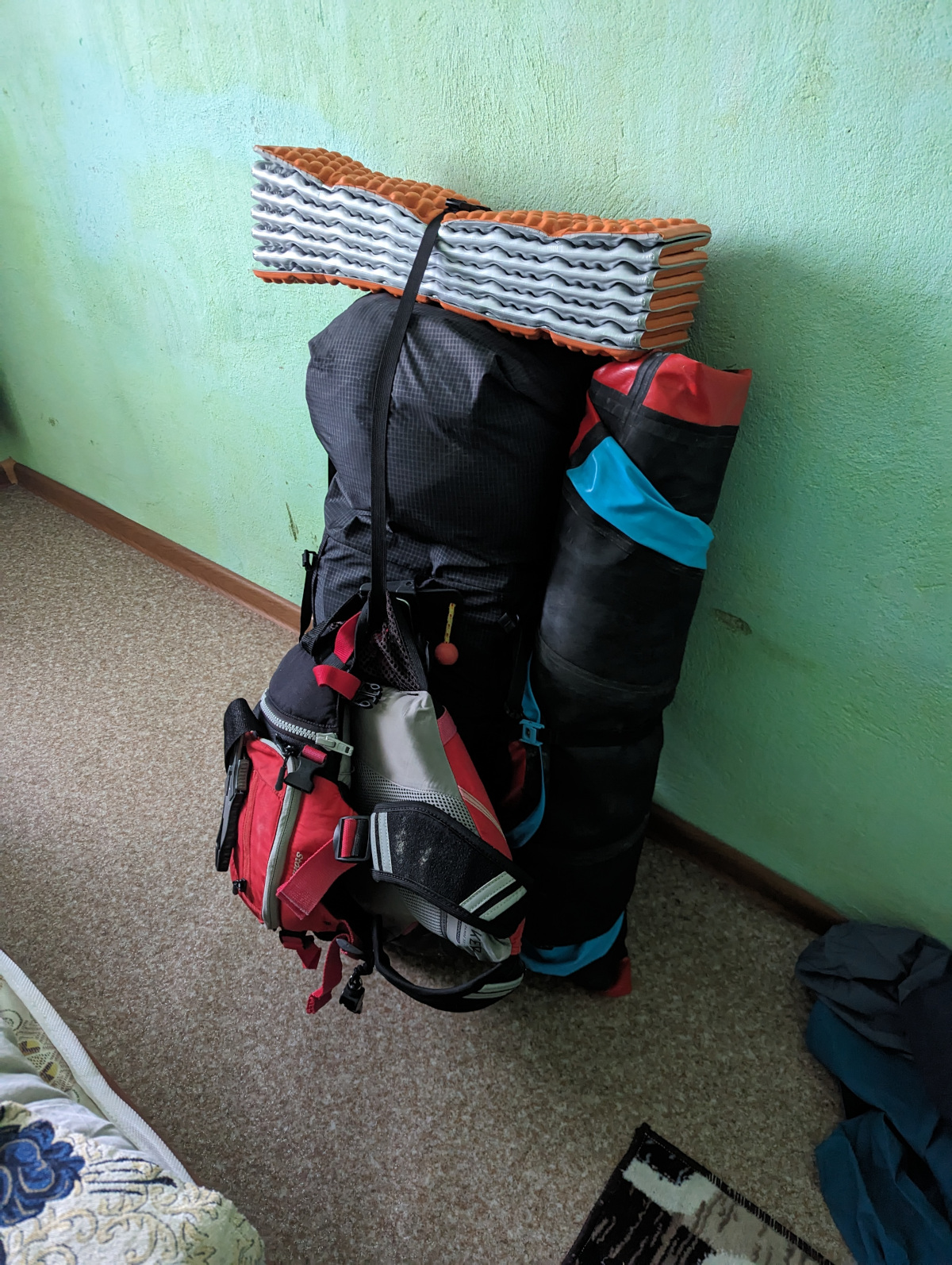
I managed to crawl out of bed to chug water and stuff twelve days of food into my bag, and like any good adventure, it was comically heavy. Very depressing. Luckily we’d be on water for the first 5-6 days and it wouldn’t matter so much.
Somehow in the course of all this, we realized our flight out was on the 5th, and that we’d actually have one less day than we planned to do the whole trip. It’s a good omen when you’re running late before you even start. With little option other than to move quickly, we decided to front-load some miles on the first day and hopefully keep our average mileage up. We’re pretty good at suffering for long chunks of time so this wasn’t too big a deal.
Day 1
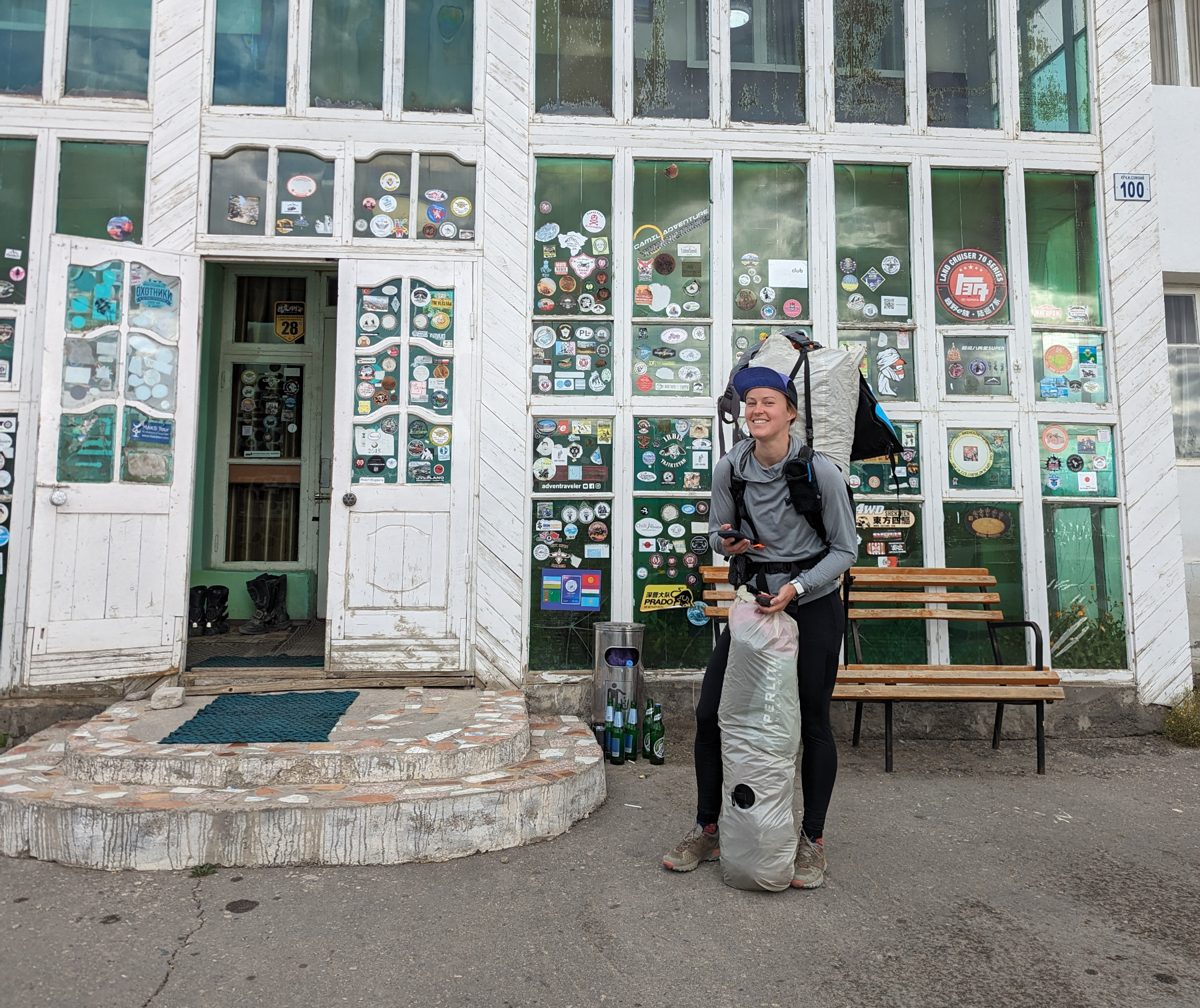
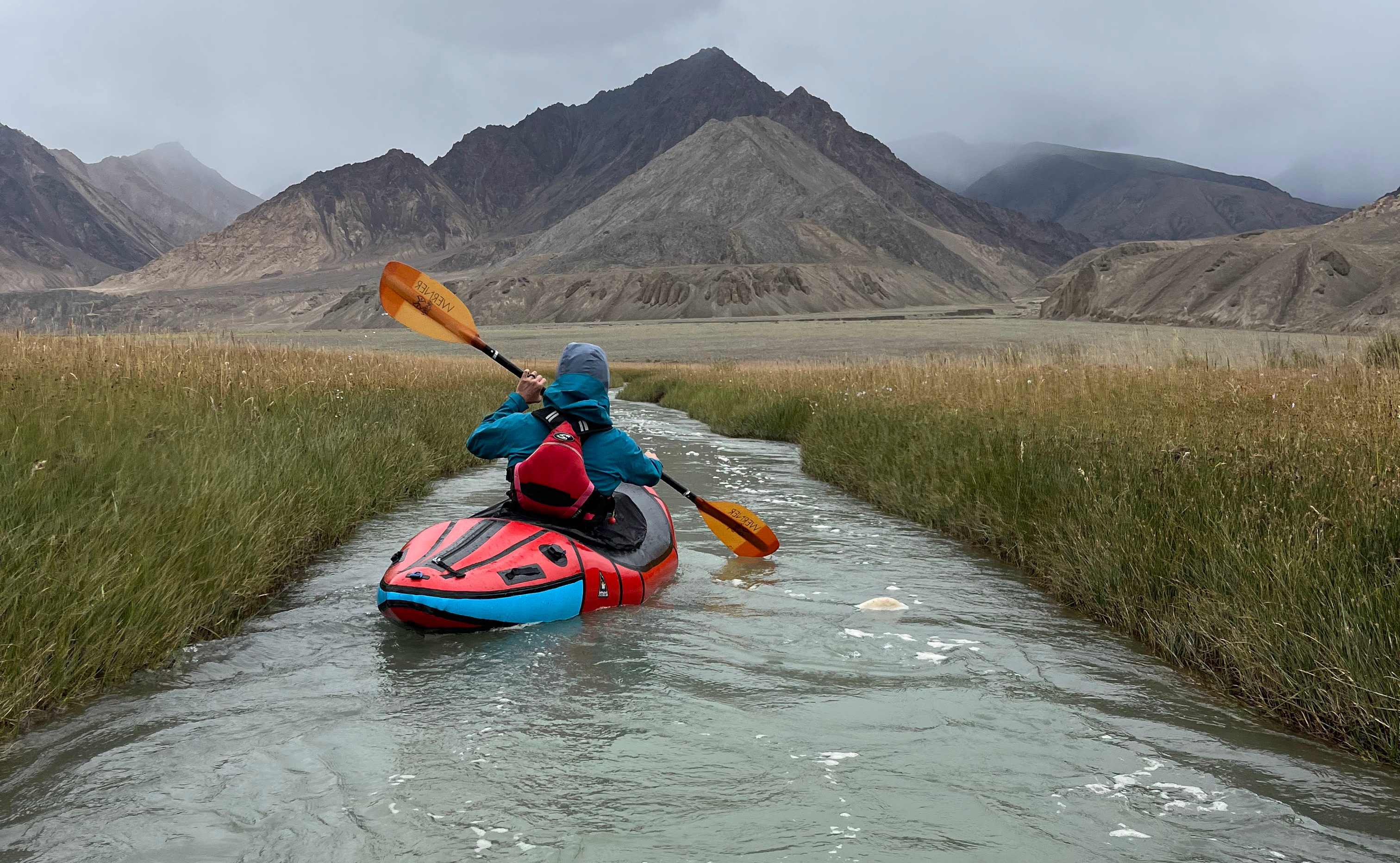
We got up early, ate breakfast and managed to hoof everything out to the river. The instant coffee and porridge I had were fantastic, and my head didn’t hurt so I was feeling even better. The walk was about a mile, and it was rough with all of the weight in the bags, but not too bad. Locals eyed us on the way down but nobody followed us to the river.

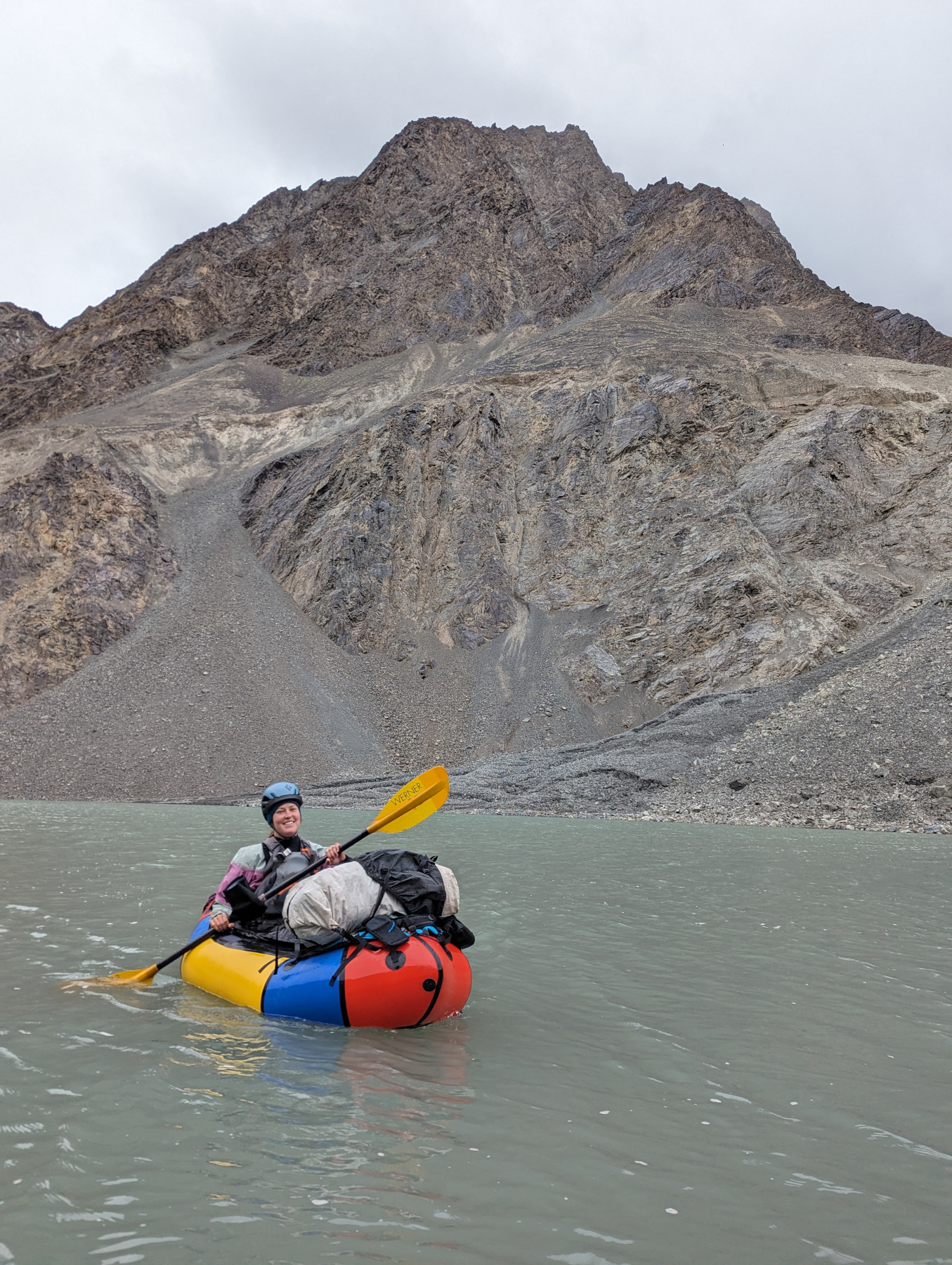
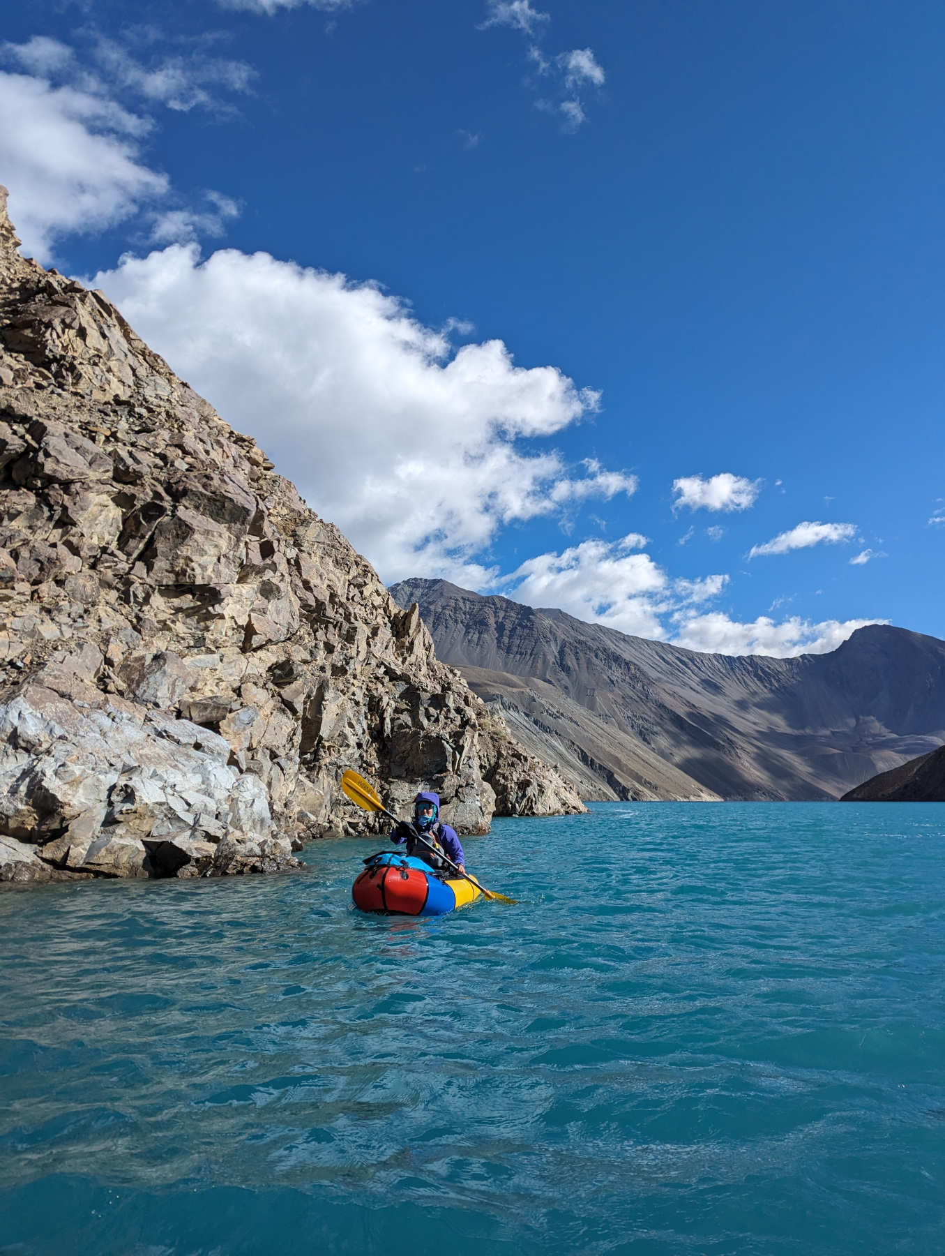
30 minutes after getting to the river and we were floating away. It was moving quite quick, around four miles per hour, which was fantastic. We were going to try and go ~28ish miles that day so that we could check out the Eli Su hot springs near Modiyan.
The river moved quickly and so did we- lots of scenic floating, scrubby plant life, people out cutting the grass with scythes, horses, wild cows and sheep, and eventually small trees once we lost enough elevation. M didn’t like the cheese she bought so I ended up taking it and eating a lot of it. Twenty miles went down pretty quickly.
We stopped at one point while the sun was out to check out a graveyard: small little mud buildings slowly dissolving in the harsh climate. No names or anything, just mounds and pits or small domes. Some locals watched us float away.
As the mountains rose up around us it started to feel more remote, and we pulled off to camp around 2PM. 29 river miles down in a few hours isn’t bad at all. I wasn’t super keen on the hot springs and there wasn’t a clear, short path to get there so M went on her own. I had some afternoon coffee and headed up the creek to see if it would be paddleable. Curious locals walked by and eyed our tent but nobody said hi.
I bailed after it became impossible to continue without a substantial creek crossing and had a little adventure on the way back: I fought my way up a super steep gully, which was very tiring at twelve thousand feet, and then came back down a road. It had started raining at this time so I was pretty soaked.
Megan didn’t get back until around 8:30, and she’d had her own adventure. Apparently the hot springs are VERY hot and they’re basically in someone’s home. She didn’t get in more than knee high, and it was more like a sauna. She tried to walk back down the creek, but turned around for the same reason I did, except she had another five miles back to camp. She put in a whole 13 miles on foot and walked/ran back in the rain. Brutal.
We ate and went to bed around 9ish.
Day 2
We woke up at six, after it rained all night. This would be a theme: Wind and rain in the afternoons and evenings. I hadn’t drank enough water and had a headache, cool- I couldn’t really eat so I just had some ibuprofen and downed a bunch of Megan’s earl grey tea, which was amazing. I felt like a real mountaineer. The sun was out too, so things were looking up.
We packed and dragged the boats up a little ways so we could paddle the small creek we slept next to, which was a good way to start the day. Then we managed to convince ourselves that the river was higher, because it was much faster and there were some class II- rapids at the put-in. It was definitely moving quickly, but I figured that we had just burned through all the gradient for the day. It leveled off pretty soon afterward.
 One of
the side channels.
One of
the side channels.
We entertained ourslves by taking small side channels and seeing if they’d get us around a bend faster. Usually they didn’t.
At one point we came upon a giant yellow house on the side of the river. We tried to talk to someone there but the language barrier was pretty thick. We couldn’t figure out what the house was there for or why it was so big, and couldn’t locate it on google maps later, either. Very suspicious. Theres nothing out there so it especially stood out.
At some point we passed the end of the road that had been paralleling the river and things felt much more remote. The mountain walls came down to the water, but there were still no rapids. I kept expecting something surprising to show up and grab us.
At some point we hung out on a gravel bar to eat and skip rocks and look for interesting stones. No fossils this time around, though.
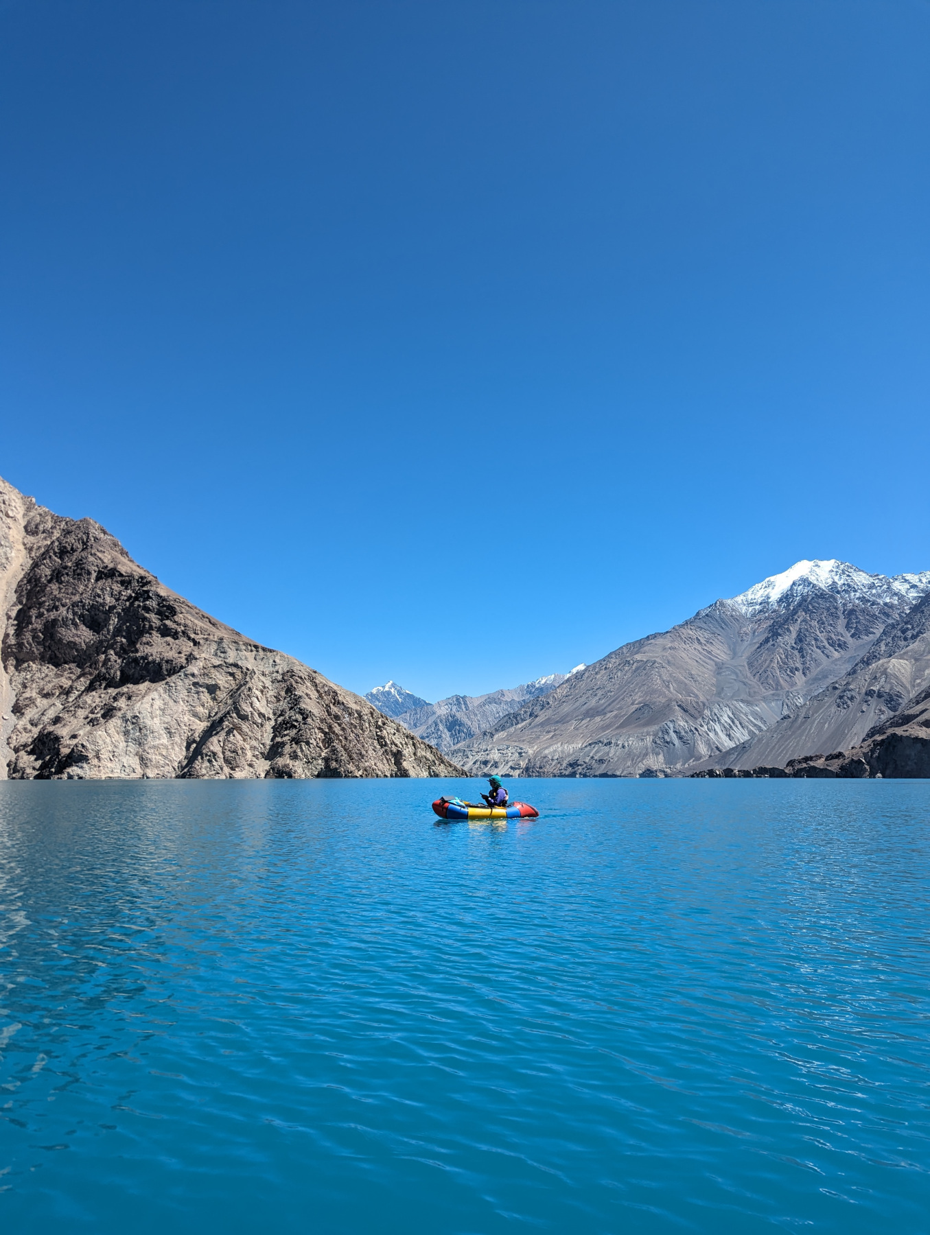
We started passing through the landslides-of-old, and the lakes they had created, and it became much hotter and slower. We skipped a good camp spot and decided to keep going into the newly formed lake. Trees started to be swallowed by the water, and nothing was moving anymore.
It’s very surreal to be in a steep mountain bowl with nothing but rock and matcha-colored water all around you. Little did we know this was just an easy predecessor of things to come.
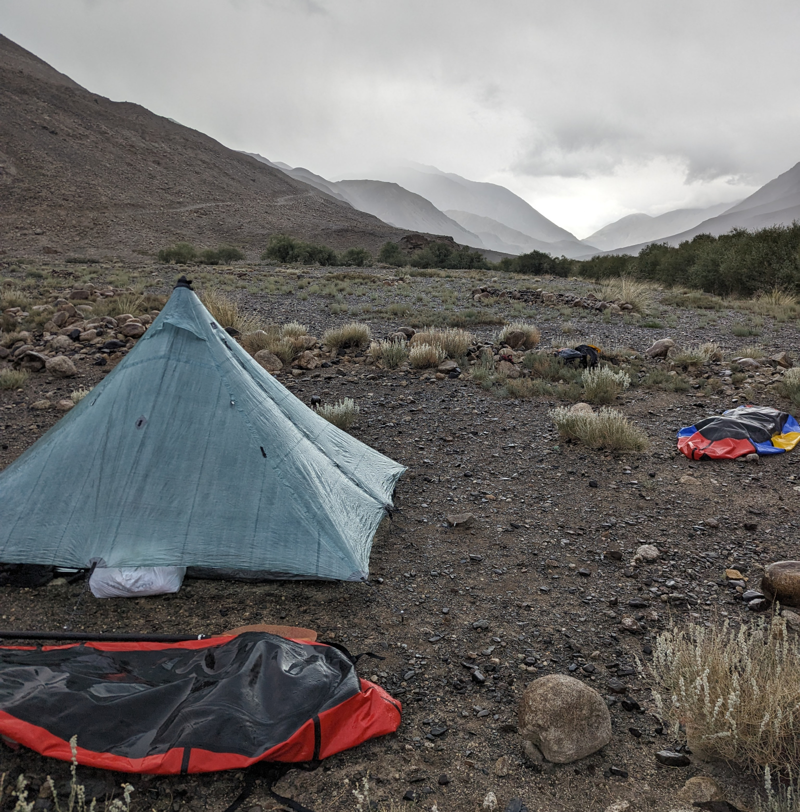
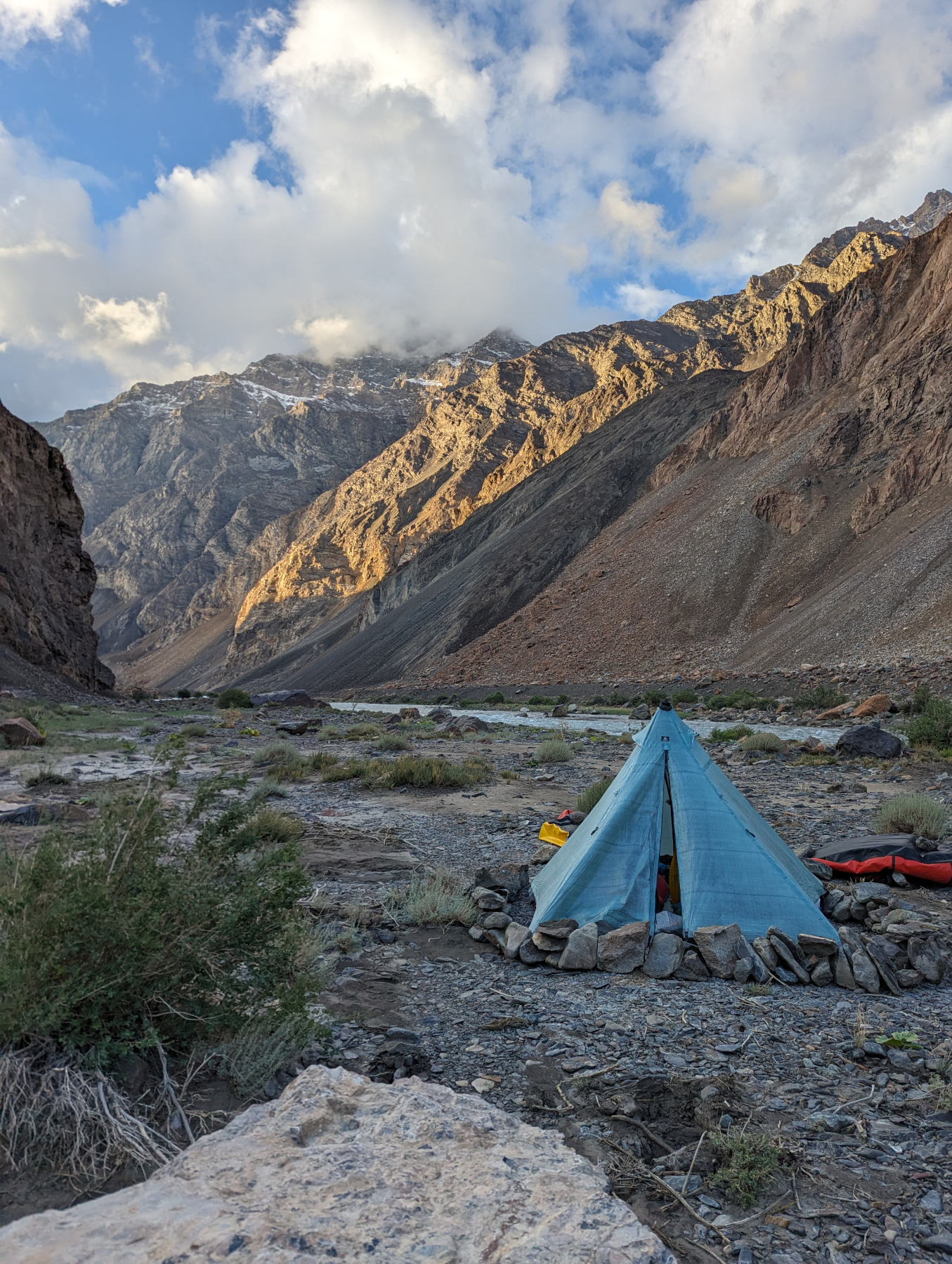
Towards the later afternoon we fought our way up a canyon, dragging boats and walking through glacial silted brush to get to a shitty campsite. We went back and forth for quite some time about camping on a high rocky bank covered in rockfall, or a microscopic, wet gravel bar.
After examining the gravel bar (it was wet and even smaller than we thought) we decided to go for the extremely sharp rockfall camp. We found the least deadly spot we could and, after maybe an hour, managed to carve out a small, smooth depression in the scree. I dubbed it Castle Quinlan. It wasn’t bad but wasn’t great, either.
 Laying
down on the only flat spot on Castle Quinlan
Laying
down on the only flat spot on Castle Quinlan
We ate around 5:30 and got everything setup just before the afternoon storm rolled in. This time I drank a lot of tea before bed, hoping to stave off the headache. I read a bit of Living the Best Day Ever which became a nightly ritual for the trip.
Tomorrow is the big day, where we have to cross our unknown landslide wall. Hopefully it doesn’t have parapets and armed guards. It didn’t take long for us to fall asleep.
Day 3
 Getting
ready to leave day 2 camp
Getting
ready to leave day 2 camp
It was windy and rainy all night but we were pretty comfy, despite pitching the tent without the bug net insert. We heard rockfall throughout the night but it was mostly across the canyon, or farther upstream. We survived.
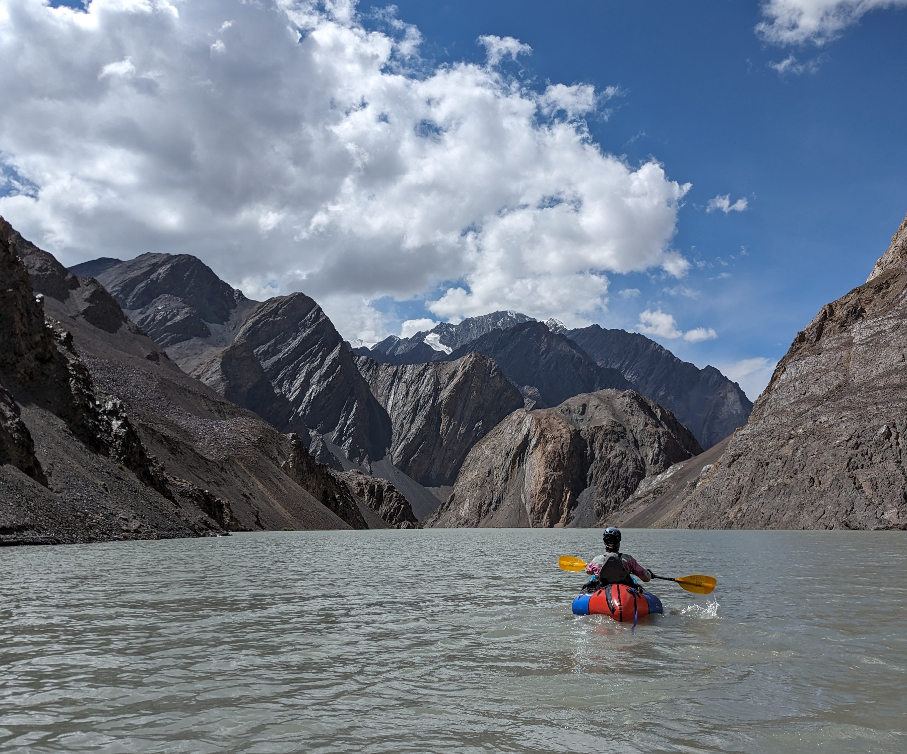
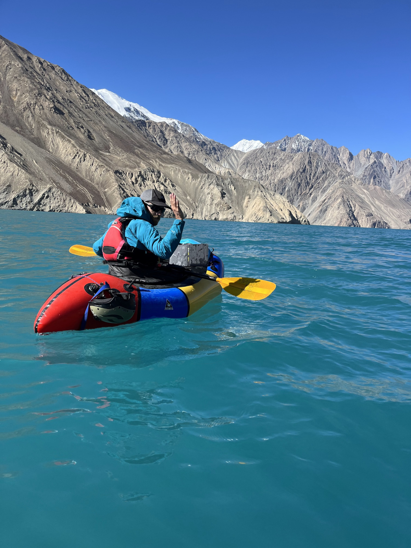
When we got up and out of the tent at six, our only alternative camp site, the gravel bar, was underwater. Good thing we moved all those rocks around instead. We left camp by 8:30AM and headed off into the lake. Megan was paddling with her pack balanced on the bow of her boat in case we had to do some steep ascent to get out of the water and over the landslide.
 Bow-baggin’
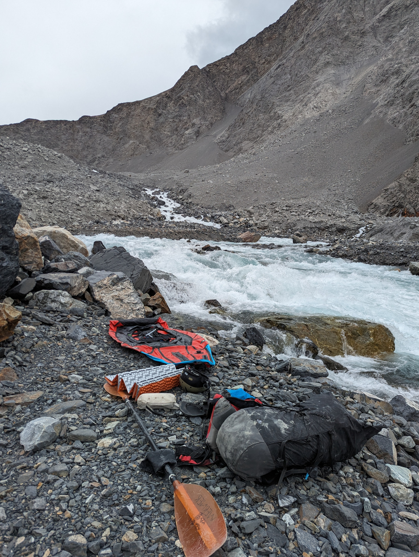
After about 90 minutes and what we thought was a lot of wind, we made it to the dam. We took one break about halfway through at another landslide protruding into the water to eat and drink before rounding the final corner to our unknown obstacle.
The first thing we noticed was that everything was covered in a fine gray dust- it filled the whole basin. We were also pleasantly surprised to see that our plan B would probably go if we needed it to, but it was a steep uphill climb through a rock-filled gully. Not really ideal.
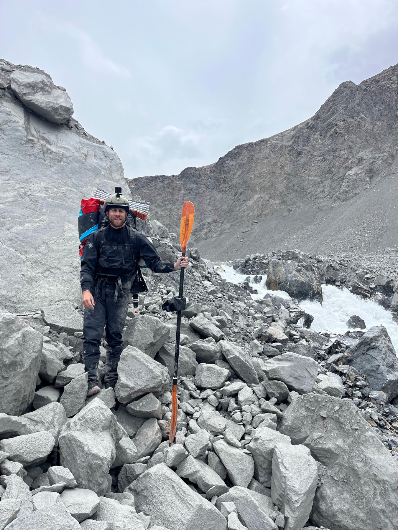
Luckily for us, it was easy to get out and inspect the new slide. It was also easy to walk around on- it was completely filled in with the same moon-dust coating the walls. We got up and looked at the water bursting through the other side, which was as crazy as you can imagine, then went to the boats and packed everything up for what was, surprisingly, an easy portage.
 Me
somewhere in the moon field
Me
somewhere in the moon field
It was only about a quarter mile or so, and it wasn’t even that bad. We’d both been expecting way worse. We blew up the boats again at the bottom and paddled out on the first real whitewater we’d seen in the whole trip. The water was coming through over the dam (colored green) and through it at the bottom (colored bright blue) and then mixing again into an azure. It was very pretty, and wildly different than the dirty green from up above the dam.
 Packing
back up to paddle away from the dam.
Packing
back up to paddle away from the dam.
We briefly lost eachother after I stopped to take some photos of Megan paddling out, but then joined back up for some fast-moving water through flooded brush fields. A pleasant float after paddling hard on the lake for a while.
 Megan
paddles out on some busy class II-III after the portage
Megan
paddles out on some busy class II-III after the portage
We stopped to investigate some rusty things we saw along the shore and ended up wandering around the abandoned hydrometeorological station for a while. I don’t have any good photos of this since I only had my GoPro, but Megan got a ton- it was like everyone just up & left after the collapse of the soviet union. Everything was bent and twisted and full of silt like it had been flooded. I talked Megan out of keeping one of the cool little brown bottles we found after she picked one up that still had mercury in it. I’m pretty sure there was asbestos around the pipes, too. A cool place, but spooky.
After eating something and putting back on the river, we started noticing weird, blackened walls that looked like they had slid or something- only after seeing them repeatedly did we realize they were just the dirty ends of glaciers. It was really, really cool to paddle right next to them
 Looking
at a crazy scimitar-shaped iceberg in the middle of the river.
Looking
at a crazy scimitar-shaped iceberg in the middle of the river.
From there we had some bigger rapids, maybe class III+ and we portaged a bigger IVish drop that snuck up on us. A big IV around a corner had us stop for the evening in a big flat-ish bank with some good boulders to hide behind should the rockfall fairy visit in the night. It had been a very full day.
 My
beautiful rock wall
My
beautiful rock wall
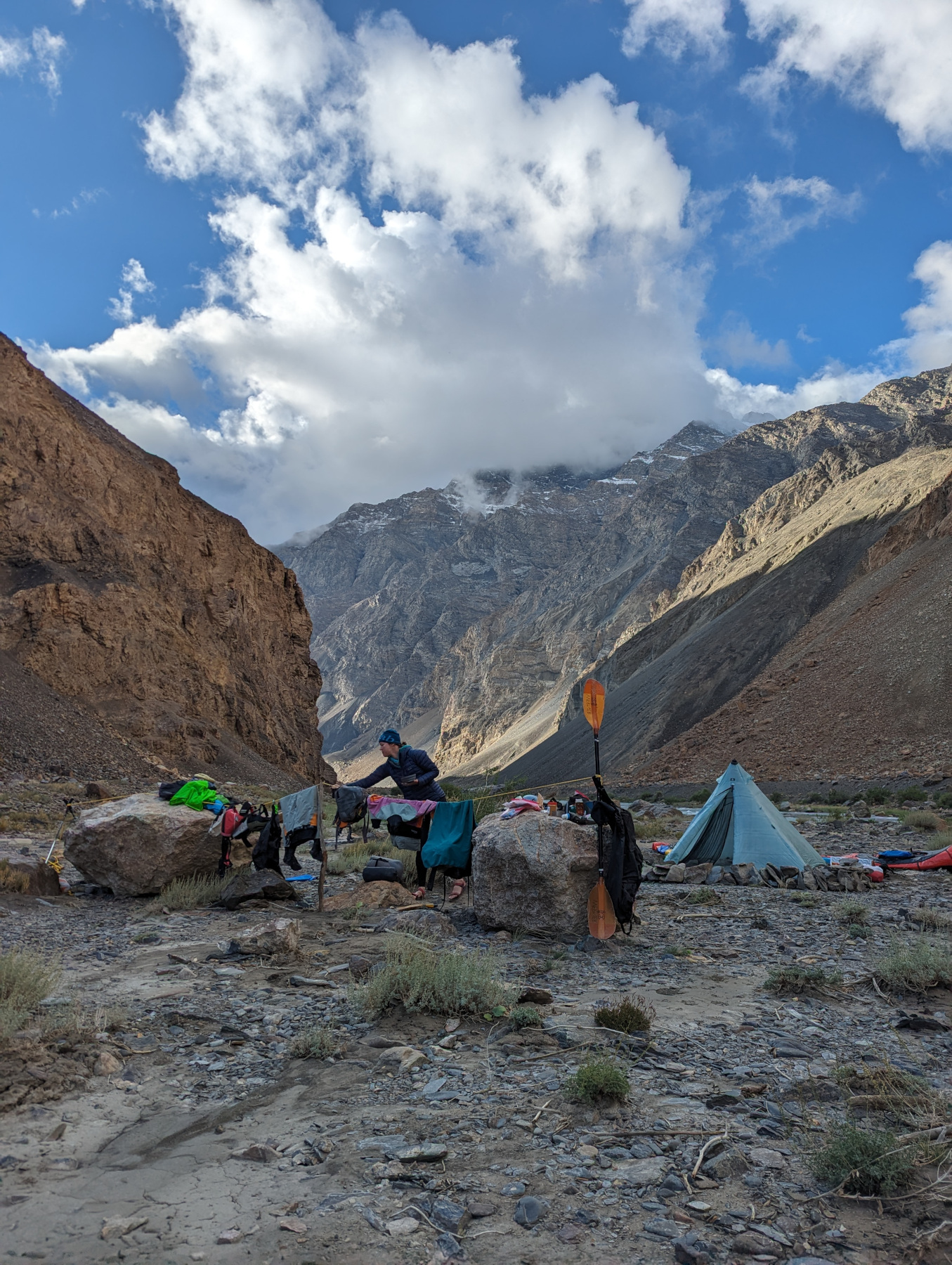
Camp was almost perfect, but the wind kicked up so the one time we wanted to have a fire ended up being a hide-in-the-tent night. I spent the evening drinking coffee, reading and moving rocks around the edge of the tent to try and hide from the wind.
Day 4
The weather was beautiful in the morning, and it was great to watch the sun creep down the canyon walls. I memorized a line through the big rapid and decided to run it, and M found an okay put-in just downstream. I aced my line and we were soon on our way, leaving one of the better camp-spots. It felt good to work a harder rapid on a remote trip and have it turn out exactly how I expected it to. It would end up being the hardest rapid on the trip.
From there we had around five miles of read-and-run class III rapids with some bigger holes, but it tapered off after the one we’d camped at. The scenery was mostly blue water, dustland, some green grass and scrubby trees.
Another landslide showed up and blocked our view of what sounded like a big rapid, so we ended up portaging it. This would be the last rapid before the lake, and we paused to eat for a while. After snacking for a bit, we paddled the run out and started paddling down the lake.
I was optimistic that we could build a raft out of driftwood and the packrafts to hopefully gain some speed since there were sticks everywhere, but I’d later realize that they were only at this end of the lake because thats where the wind pushed them. There would be no other wood until our take-out, 35 miles later.
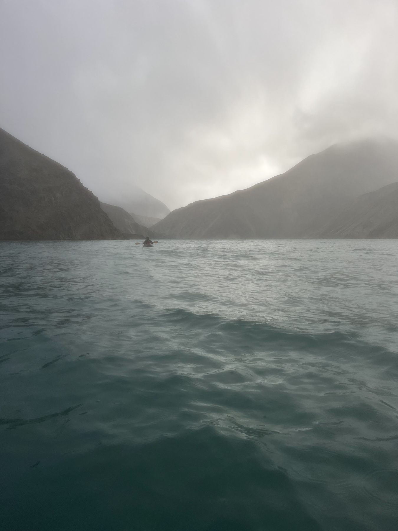
We paddled for ages. The wind picked up in the afternoon and it only got way worse. We stopped once for a potential campspot because the going was so rough, and M wanted to bail for a highroute but I convinced her to keep going. After that the wind really picked up and I wanted to bail, but she convinced me to keep going instead.
It’s hard to overstate how bad the wind and the rain were. They absolutely whipped us going around corners. I could go a little faster than M so I was making oh, one mile per hour? She was somewhere under that. It was insane. We’d paddle from wall to wall along the lake, hardly moving at all, then a gust would hit us and we’d shelter, then we’d hide in a little eddie, then do it all over again. It was very slow going.
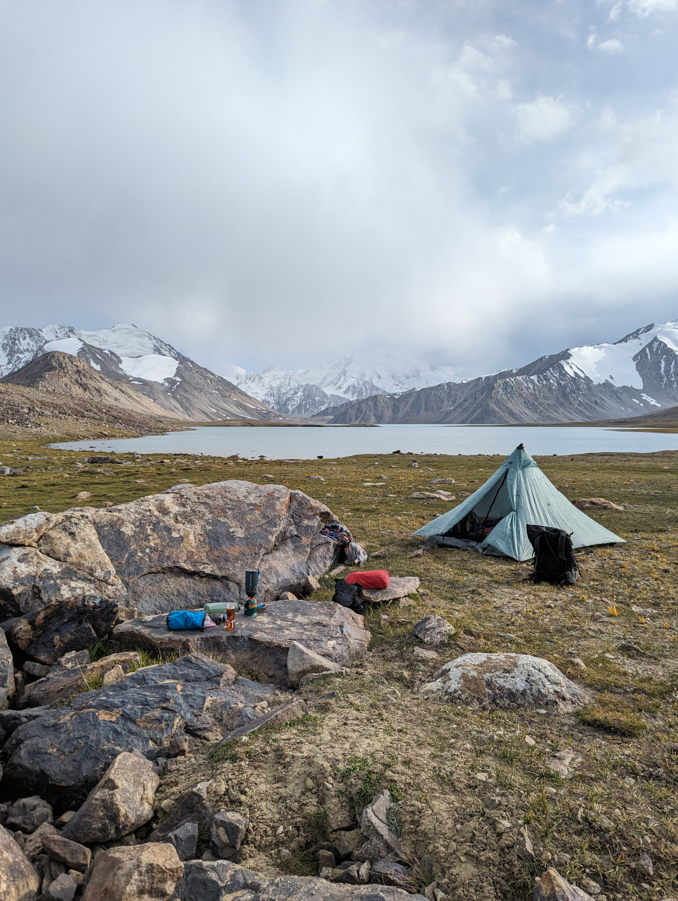
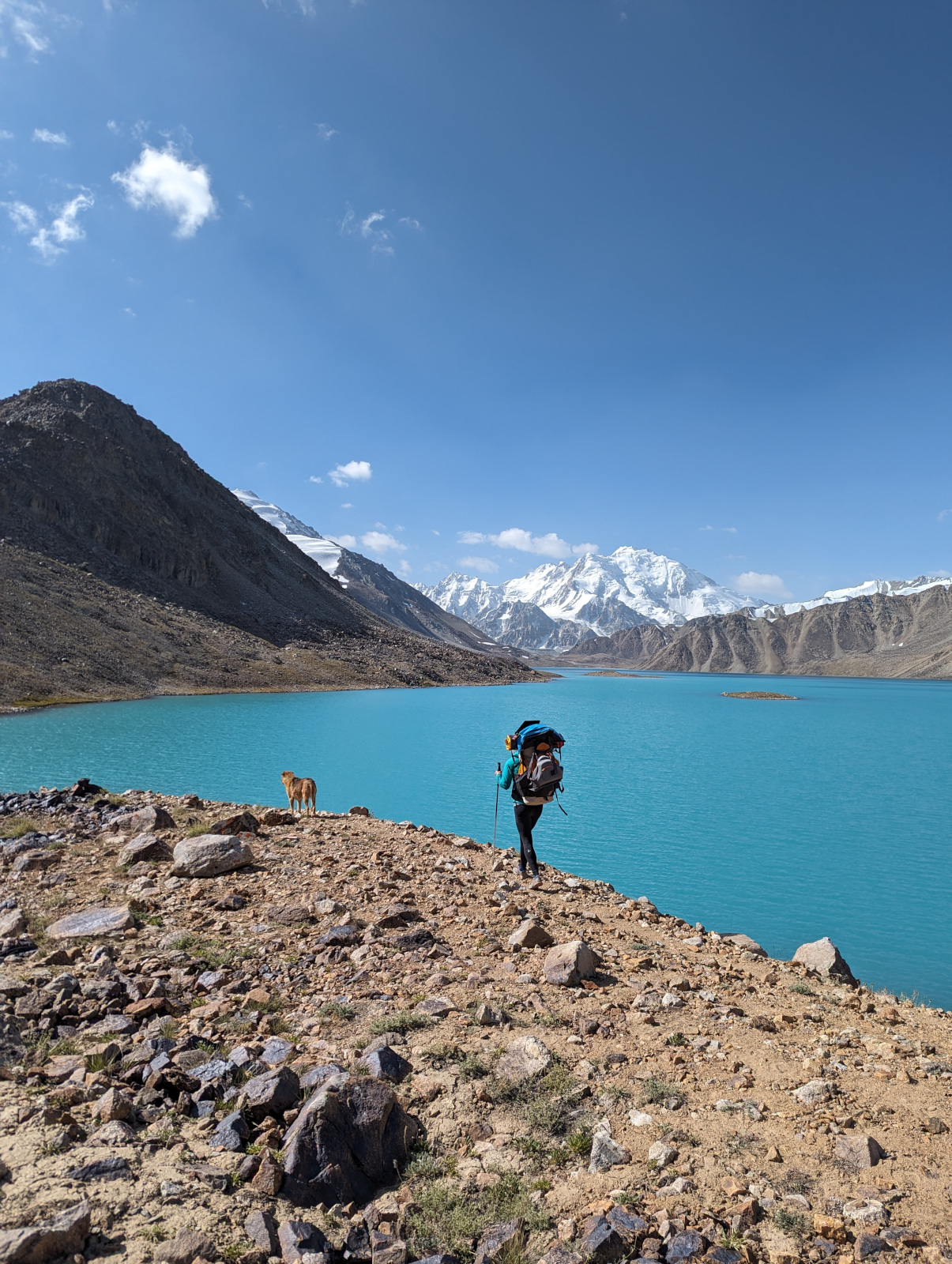
Eventually we spotted land we could potentially get up onto (since the walls were so steep everywhere), but a beach surprised us before we even got there. We arrived on this fantastic little oasis around 7:00pm, and immediately upon landing the wind stopped, the lake became glassy and the clouds cleared. We could see all the 6000 meter peaks around us, with fresh snow on top. It was savage, and we were absolutely tired.
We ate and went to bed. We slept well until the tent partially collapsed and I had to walk around in the dark looking for rocks to prop everything back up.
Day 5
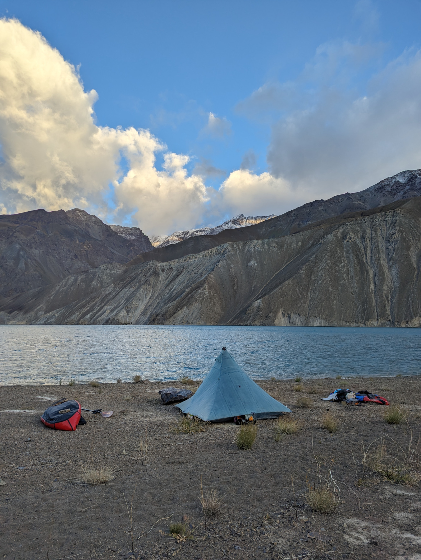 Morning
on our little miracle beach. Notice fresh snow in the mountain
tops.
Morning
on our little miracle beach. Notice fresh snow in the mountain
tops.
Perhaps traumatised by our awful, million-hour paddle from the day before, Megan suggested we wake up at 4AM. While we were awake earlier, we were also a little slower in leaving camp and didn’t head out until around 7AM.
We paddled all day. It wasn’t bad at first, just a big treadmill with a minor headwind and clear skies, but it got bad later. Megan’s boat paddles like a sheet of plywood, so it was much more tiring to move. We passed the time with 20 questions, I spy, and other little games. I even came up with a song I’ve already forgotten.
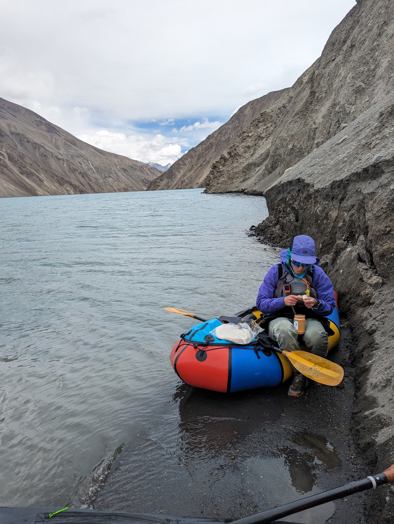
We paddled and stopped a few times for snacks or Peanut Butter Tortillas. There weren’t any great places to stop, just shallow little sand pits on the side of scree slopes. We tried not to linger as rocks and dirt slid down around us.
I was frustrated, Megan was in pain, and times were rough, but we made it through eventually. We found a weird little nook and managed to scramble up to a plateau, where we ate in the sun and decided to call it for the day despite not having gone super far. We kept double-guessing the decision when the lake would go flat, but decided there was no other place to camp in the near future. 7AM to 2PM isn’t too bad, right?
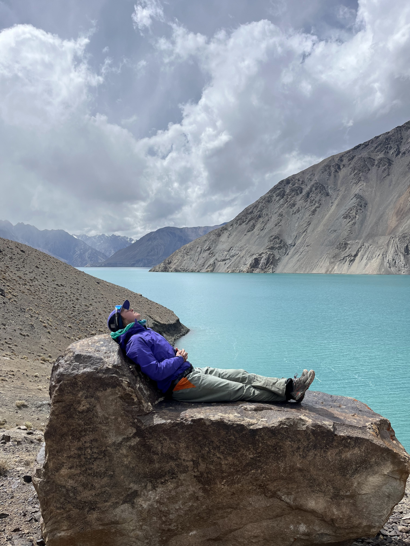 Megan
lounging on the perfect boulder
Megan
lounging on the perfect boulder
It turned out to be a good spot, and we spent the evening wandering around looking at small rocks. Megan found a really cool little crystal, and we decided to pitch the tent on the ridge despite the wind picking up later. It was an absolute pain to haul everything up there, but we were thankful for the flat ground. I somehow managed to spill my dinner, but it was still dry so I managed to get every single dehydrated noodle back into the bag. Calories are calories!
We were in bed by 6:15PM.
Day 6
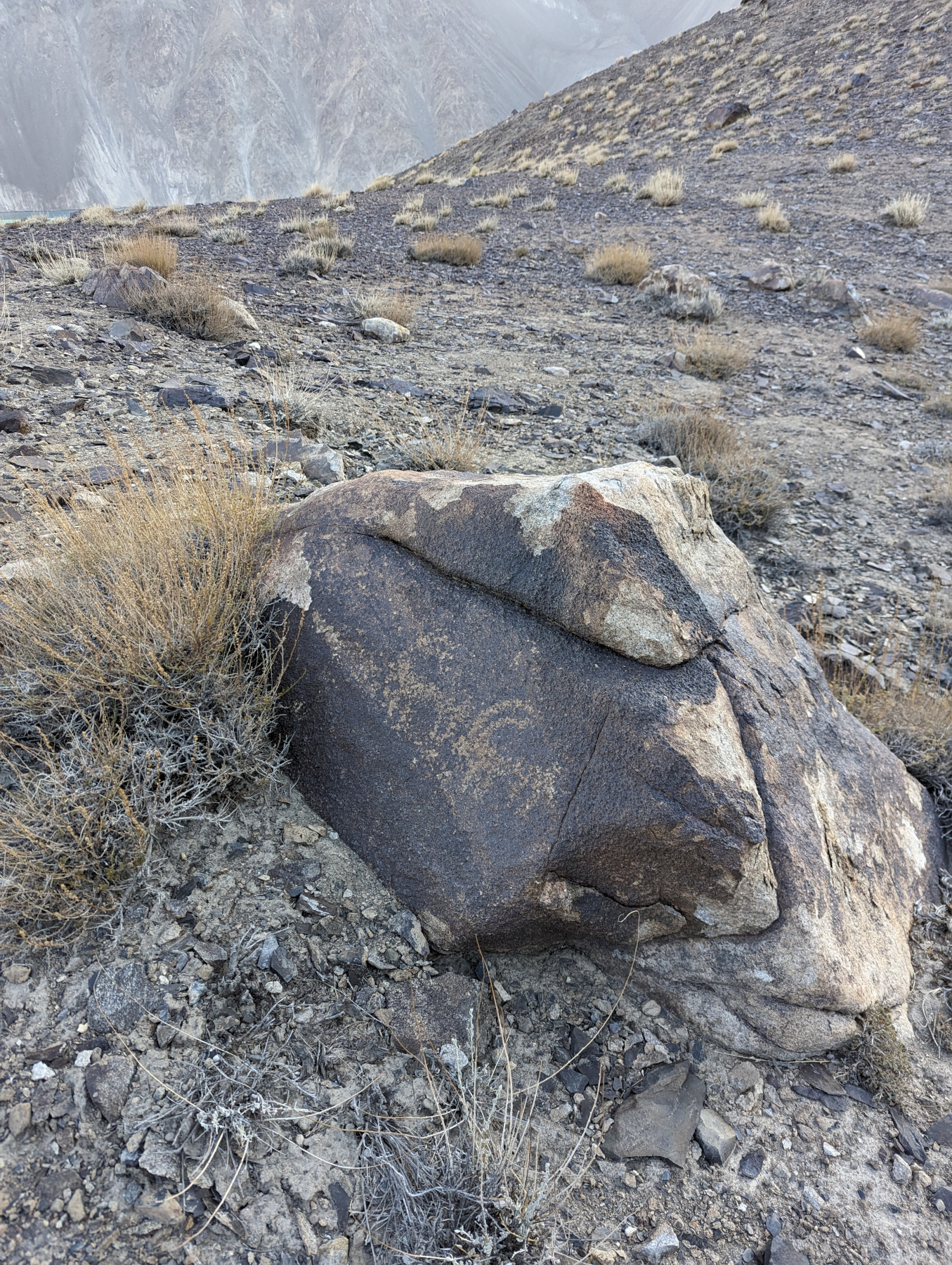 A
petroglyph of two mountain ibexes
A
petroglyph of two mountain ibexes
We slept in just a little longer, until 5 AM, but managed to leave around seven. While wandering around in the morning looking for my buff (which probably blew away) I spotted the above petroglyph- our only one of the trip. It was especially cool because the lake we’re on has only existed for about a hundred years, so whoever made it was tromping around WAY up high in the mountains looking for dinner. Very cool to connect with someone back that far in history. There are many more petroglyphs in Tajikistan so it was fun to find our own.
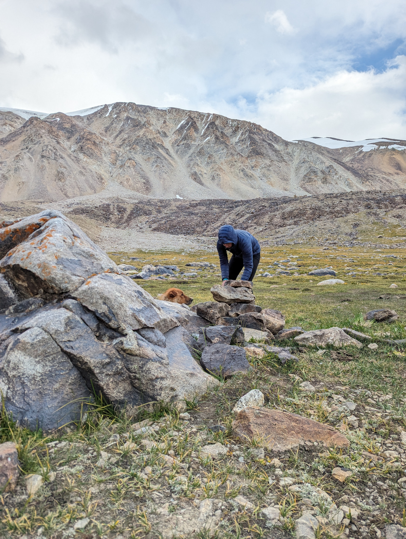
I started off the day paddling Megan’s boat, which was pretty hard work, for about two hours and forty-five minutes. I was unhappy and sore when we finally stopped seven miles later to eat and trade boats.
 Yours
truly suffering through the flatwater
Yours
truly suffering through the flatwater
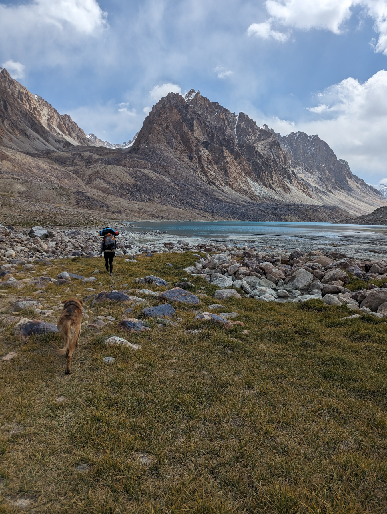
We traded boats and immediately afterward the wind stopped- like dead quiet. It was fantastic. We made good time from there down to the Irkht valley and the second meteorlogical station of the trip. It was wild to paddle across the lake when it was flat, because there was no frame of reference- light bent around the edges of the water so you couldn’t really tell if you were moving or not. Still, it was a welcome break from the constant assault of the wind.
 Flatwater with no wind- amazing
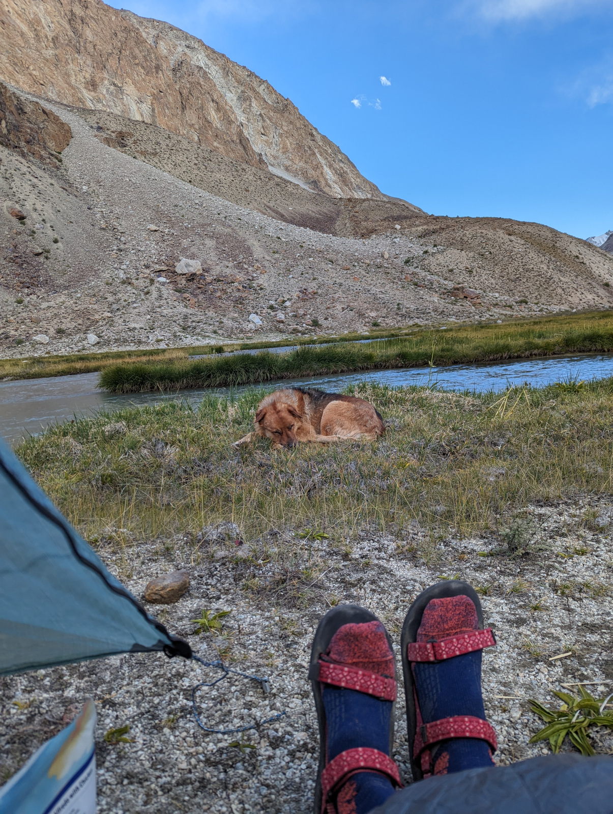
We arrived to our take-out early afternoon, where a dog and the one-eyed caretaker met us. The dog hung around but the caretaker left us alone after we unpacked and set up camp. There were a lot of bugs, but an easy campsite was also very much appreciated.
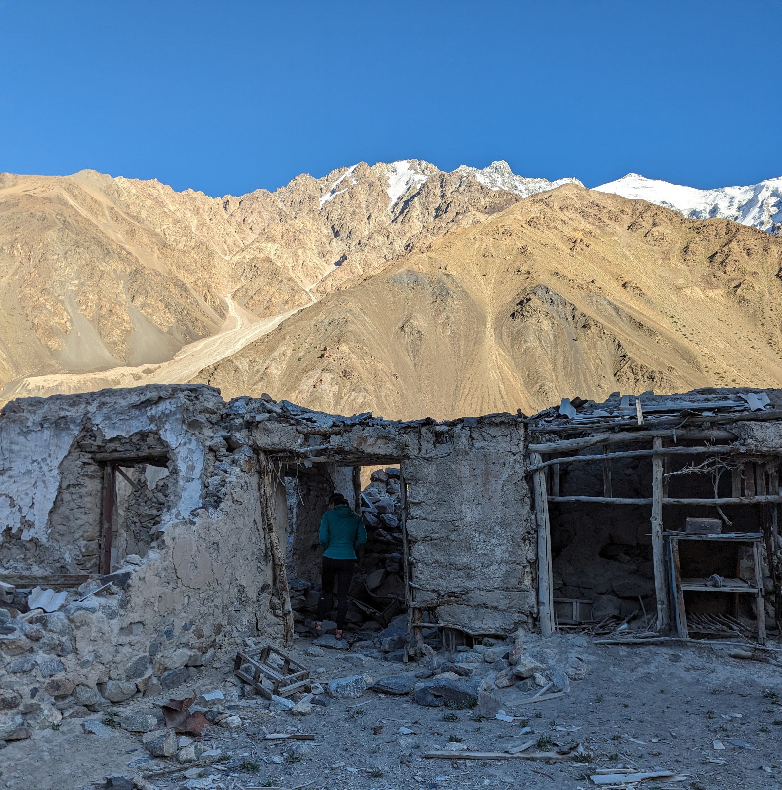
We spent the evening wandering around the valley, inspecting the various dwellings in states of disrepair. Lots of stone houses slowly returning to stone piles, and mud houses dissolving into the earth. Broken glass everywhere.
We both ate too much sausage and ended up giving some to the dog, which might have been a mistake.
 An old
mud and stick house falling apart
An old
mud and stick house falling apart
Day 7
 Megan
with her pack and our new dog friend
Megan
with her pack and our new dog friend
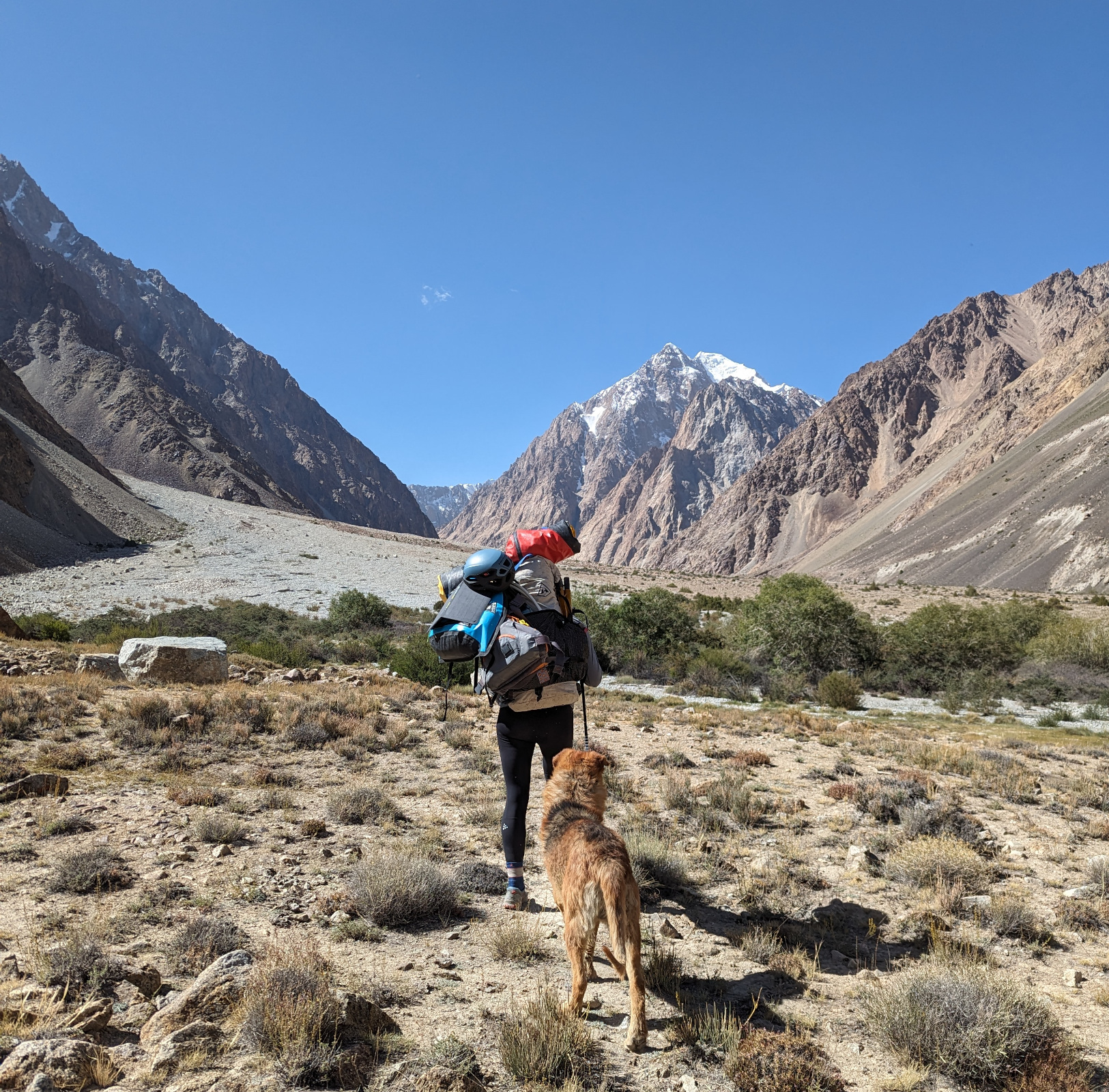
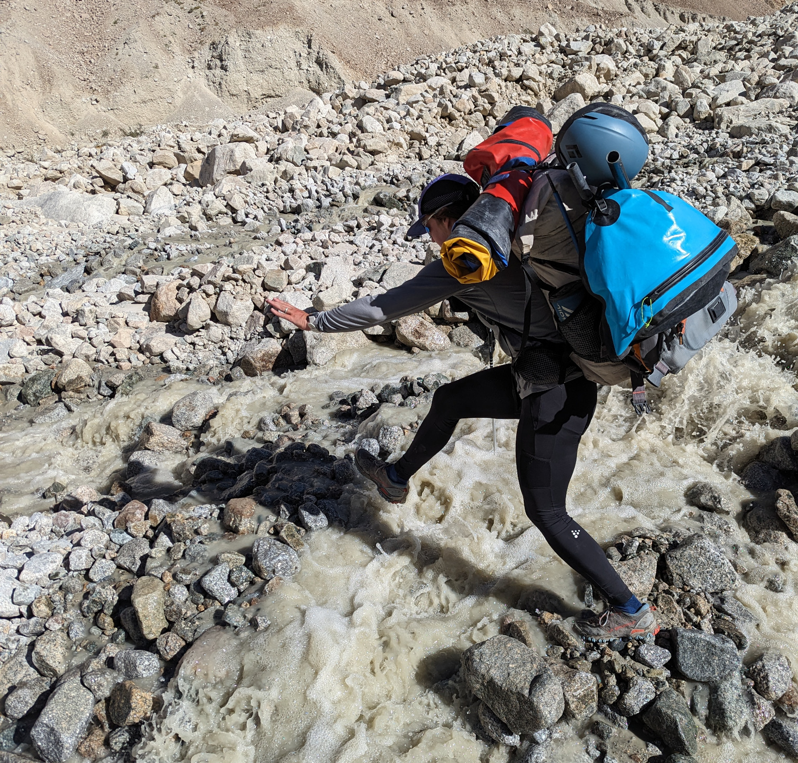
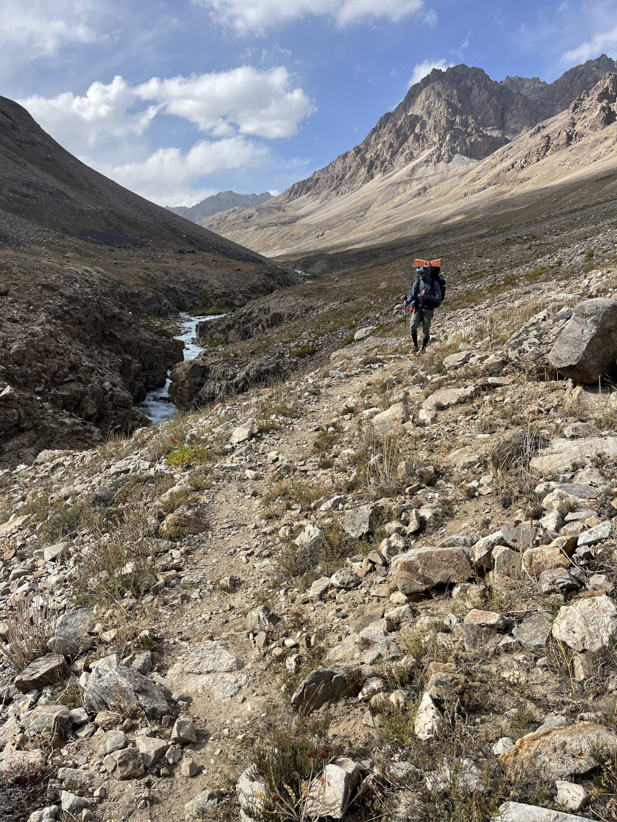
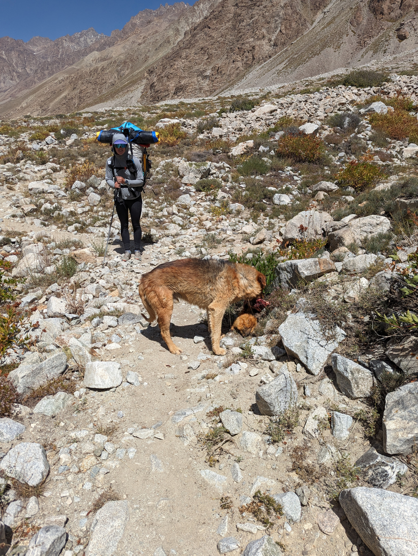
We set the alarm for 5AM but snoozed for 30 seconds and got up at 6AM instead. We were packed and moving by 8. The bags were heavy, but not impossibly so. We made pretty good time for the first few miles, but slowed down when the terrain became worse. Lots of marshy mud, interspersed with walking through boulder fields. The boulder fields would become a staple for the next four days.
The dog surprised us, and kept following along, even with a few river crossings. We fed him cheese and sausage, which he liked. Megan slipped a few cookies in there too. He was a little trooper.
 Megan
hops a side stream
Megan
hops a side stream
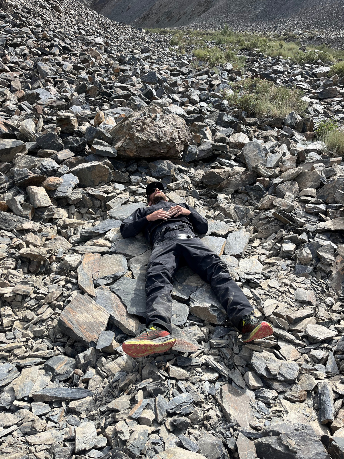
It was pretty slow going, and we stopped to drink often. I slowed down considerably after we punched back above 12,000 feet, but Megan just kept right on stomping ahead. The 400 calorie instant latte I bought cut the sting just a little bit, but it was still tough. We passed some very cool granite gorges with tall, slim waterfalls in them and lots of little side valleys. Naturally these are impossible to take good photos of with a phone.
After ten miles of varied, hard, uphill terrain, we can’t decide where to sleep and eventually end up on a flat, sandy bank near a small river. It’s acceptable but not awe-inspiring. At least we have access to water. We’re both dead-tired and it’s not hard to fall asleep, even after drinking an evening cup of coffee.
 Our
sweet boy after a long day of hiking through the heat
Our
sweet boy after a long day of hiking through the heat
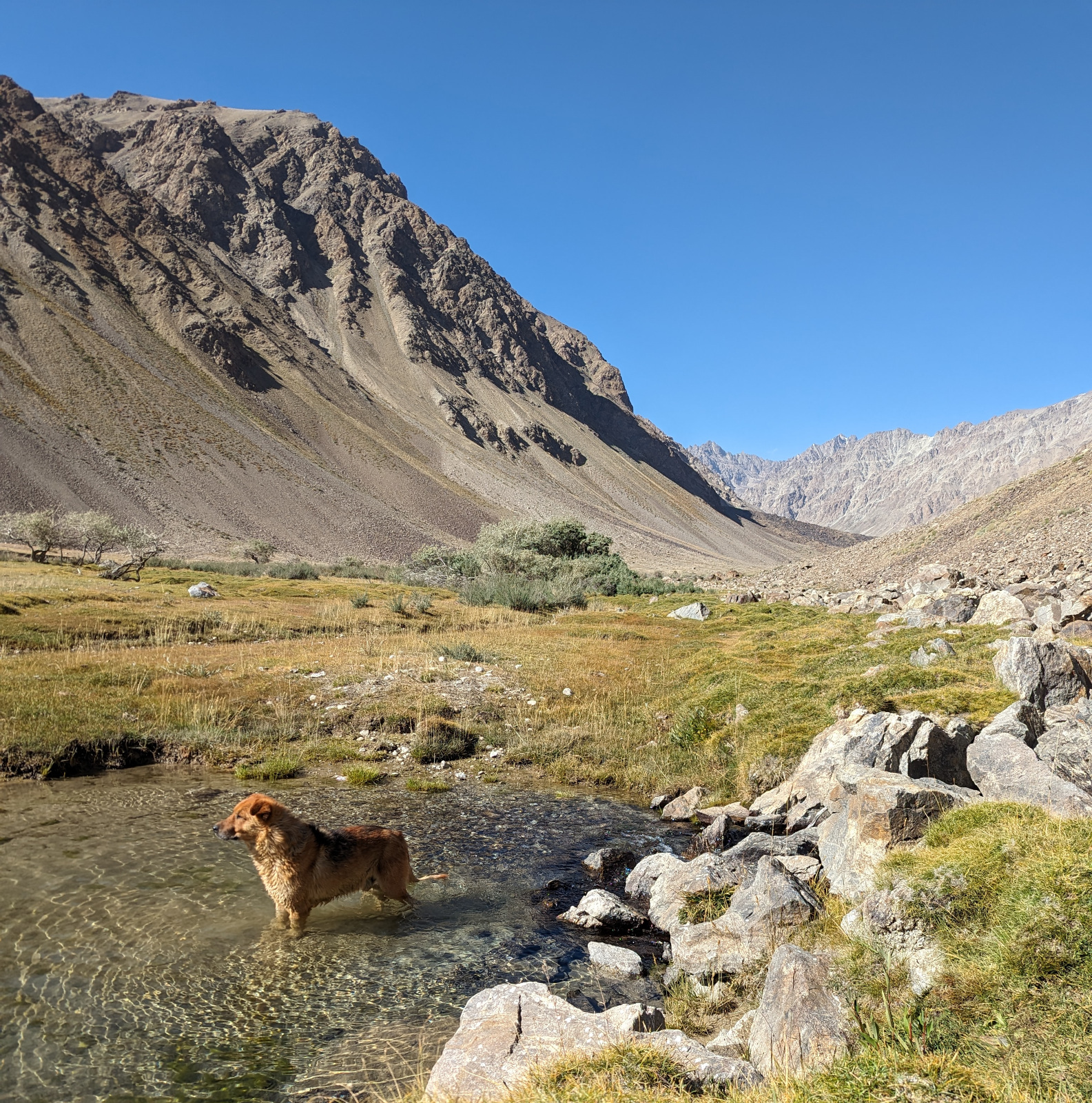
The dog curls up and shivers through the night without complaint.
Day 8
 The
team snoozing on a rock near one of the many alpine lakes
The
team snoozing on a rock near one of the many alpine lakes
I struggle to get out of bed, as for once my decade-old sleeping bag is nice and warm. The moon had been crazy bright, so I was in and out of sleep all night long.
The day starts with a bang, as M crashes and burns in the first river crossing: we’d taken our pants off to avoid getting anything wet, and she ends up with some nice shin rash. Luckily theres no real damage and we patch her up and continue moving.
The day is markedly different than the others, with some cloud cover, rain and even a little bit of snow. I learned my lesson back in Kyrgyzstan and brought an actual rain jacket this time, so I was adequately covered. It’s nice and chilly while we move but we warm up.
I’m moving a little faster than the day before, but we gain another two thousand feet so all my cardio progress at alitutde is moot. We pass through a sheperd camp, which is interesting, but nobody invites us in and we make it through without any angry sheepdogs chasing us. Theres a really cool feature near the sheperd camp where the rock cuts straight through a wall and out the other side, its like a gateway into the valley.
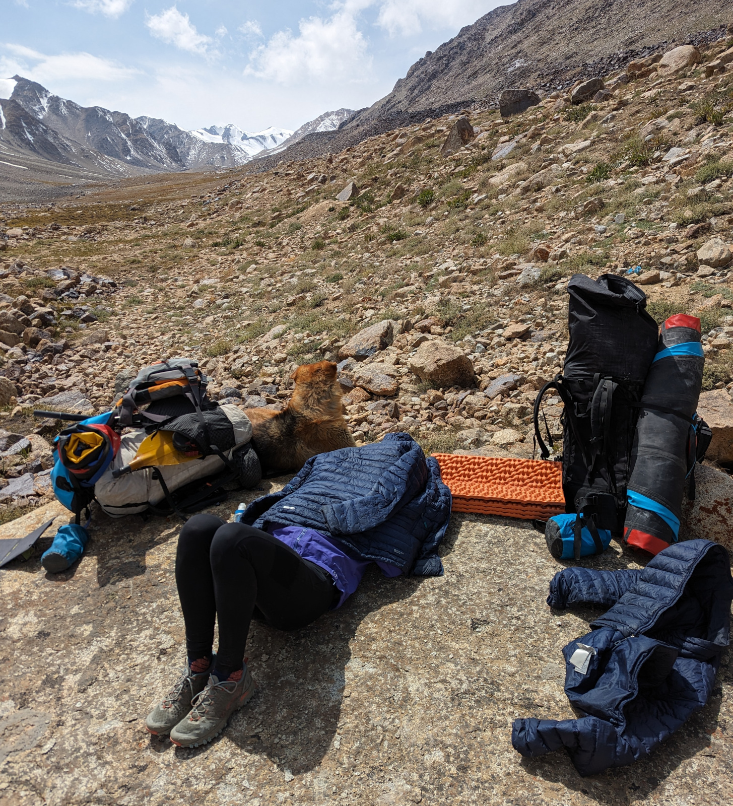
It doesn’t take long before we top out and we’re walking through an alpine field, passing lakes as we hike up towards our high point. I’m moving very slowly, and the packs are exhausting. We stop and eat some tortilla + peanut butter, and nap for a minute in the sun. It’s very nice.
Eventually we make it to camp for the night, around 14,500 feet. The wind comes and goes, with some light snow sprinkling, but it’s pleasant aside from the trash everywhere. It kinda sucks when you work super hard to get up somewhere and theres just empty cans all over the place.
 Megan
builds the dog a little windblock
Megan
builds the dog a little windblock
We’re both absolutely wasted, and fall asleep quickly. After my evening adventure coffee, of course.
Day 9
 One of
the million bright blue alpine lakes we passed
One of
the million bright blue alpine lakes we passed
It’s our final day of going up, but we’re largely trending down. We assumed it would go fast. We gave the dog more sausage, but we were starting to run low. The packs feel lighter, but stil very, very heavy. It feels silly to carry all this heavy paddling gear up so high.
After passing through lower Vikhinj pass, we thought we’d be in the clear, but we’re mostly walking on wobbly rock. The morraine that we’d pass through was especially difficult. It was, however, really cool to watch the river just completely disappear into the rock- totally gone. We would hear it echoing up sometimes through the rock as we wandered through the rifts and valleys of it.
 Walking
along near the gorge below the morraine
Walking
along near the gorge below the morraine
I felt a lot better as we descended and was able to keep up with Megan and the dog (who didn’t like to walk behind me because I was slow) and was infatuated with this class V gorge that emerged next to us. It started off okay looking but ended in a crazy, sieved out drop with huge boulders in it. Very cool.
At some point our little spirit animal rolled in a dead cow along the trail so we had to give him some space, but we all made it to camp together. I don’t think I’ve ever felt such a deep fatigue. At least Sockdolager makes a comfortable pack so it wasn’t too bad.
 Are we
tired of alpine lakes yet?
Are we
tired of alpine lakes yet?
Camp was a marked spot near a hot spring, so Megan was psyched. We are, again, totally exhausted, despite walking downhill. I eat chunks of sausage and feed the rest of it to the dog. We’re optimistic about paddling out, but I’m not so sure, it looks steep.
Day 10
 The
dog finds half of a marmot to eat on the trail
The
dog finds half of a marmot to eat on the trail
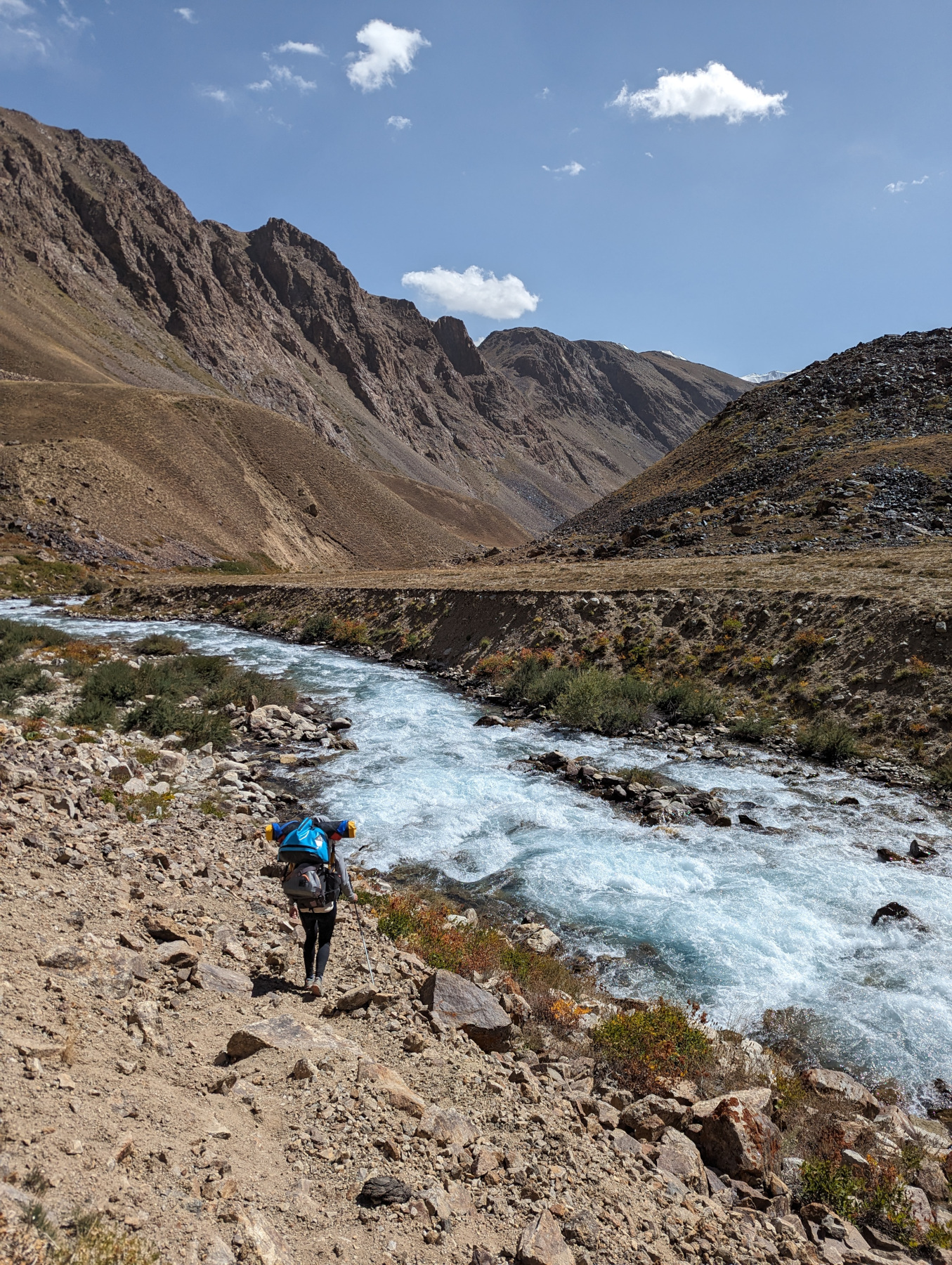
The final day- Megan wakes up super early to hike up to the hot springs. I hide in the tent for a while sipping coffee, before hiking a few miles sans-pack to check out our potential escape river. It looks steep, stiff and very fast so I make the decision not to run it. Luckily we have some of the best trail of the entire trip along the river, so we end up moving quickly.
Megan eventually comes back down from the hot springs (which are apparently very cool, way high up the canyon) and we head out.
 Hiking
out along the river
Hiking
out along the river
We spend the day eyeing rapids, walking along the trail, baking in the sun and stopping to eat. It’s not bad, and we make pretty good time.
 Basking in a trail-side spring
We have to do a fairly serious river crossing towards the end of the day, so we think it’s finally going to be time to say goodbye to the dog, but he ends up making it as well in a dramatic, disney-style moment. We’re all pretty psyched on the last few miles into Bachor.
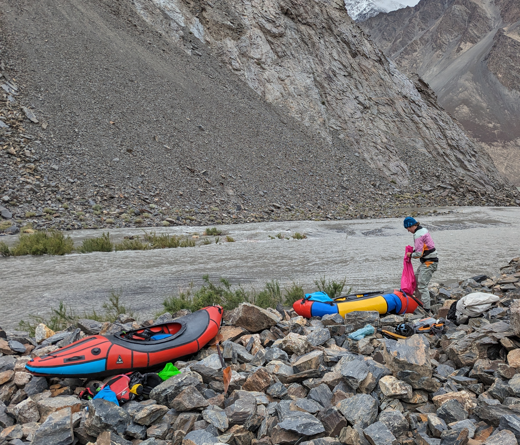
We wander around for a little while before contacting Sharaf over at Pamir Trips to send us a driver, and we’re invited in to stay with a family in the village. It’s nice since there was a big group ahead of us and we weren’t sure where we’d be able to spend the night.
We eat our fill of cookies, fruit, potatoes, bread and drink more tea than you can imagine. The family is very nice and we have a good time before falling asleep at nine. Adventure completed.
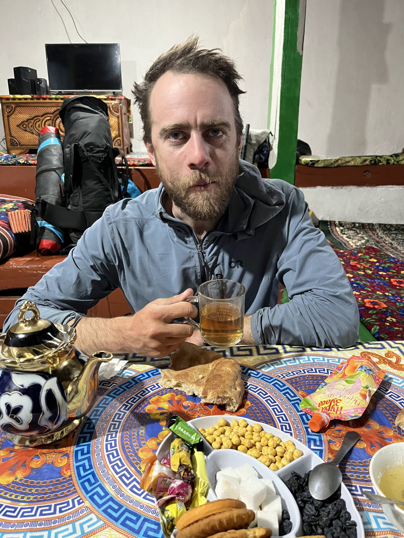 Fully
zapped at the guest house
Fully
zapped at the guest house
Post-credits Scene
Thanks for reading, I hope you enjoy the write-up. Thanks to Sockdolager for a great pack, Sharaf for running logistics, and Megan for still wanting to be married. It was a difficult trip, but not a hard one, and I am immensely proud of it. Heres to many more adventures in central asia in the future.
Oh, and the dog is, as far as we know, living a happy, wild life in the town of Bachor. The last we saw he was making friends with a boy and some other dogs.
