South Nahanni 2022: Little Nahanni
After several years of set-backs and showstoppers, it finally happened: The logistics gods all aligned and we were able to put together a once-in-a-lifetime river trip down the South Nahanni. I won’t go into the background about why this place is so special, but I encourage you to read our primary inspiration and to check out what Wikipedia has to say about the Nahanni.
To start with, it’s a seldom-visited, storied destination with some rather rather famous landmarks. The whitewater isn’t really anything to worry about since it’s primarily a canoe trip destination, but it was still something to think about.
It’s a perfect river trip for packrafts, and one of the 50 classic climbs of north america is right along the river, the famed Lotus Flower Tower. M has had this climb as an objective for a really long time, and it’s a phenomonal multisport trip: Paddle for a while, climb for a while, paddle out. The route’s difficulty is supposedly in the range of us mere mortals, too, so the trip needed to happen.
Preamble
This was a big trip, and this is a big report. I’ll probably break it up over three of four different pages. The team is six people: Whitney, M (Megan), Scarlett, Mitch, Dirk and myself.
Training, Logistics and Testing
Logistics
I think this trip had more logistics to solve than any other trip I’ve done. Just look at the numbers:
- Permits for six people
- Shuttles for six people (10 hours of driving from the take-out to the put-in)
- 25 hours of driving just to get up to the take-out from Portland
- Food for 22-25 days
- Who was bringing/taking what group gear
- A plane to shuttle in our climbing gear and additional food
- The logistics of the climb itself
There was a lot to do even before we started driving north. We had several meetings beforehand to figure everything out, with some people taking on the bureaucratic element (Permits, park staff), others managing some food stuff, others planning out the shuttle. It was pretty involved. We had spreadsheets, meetings, calendar invites, all of it.
Training
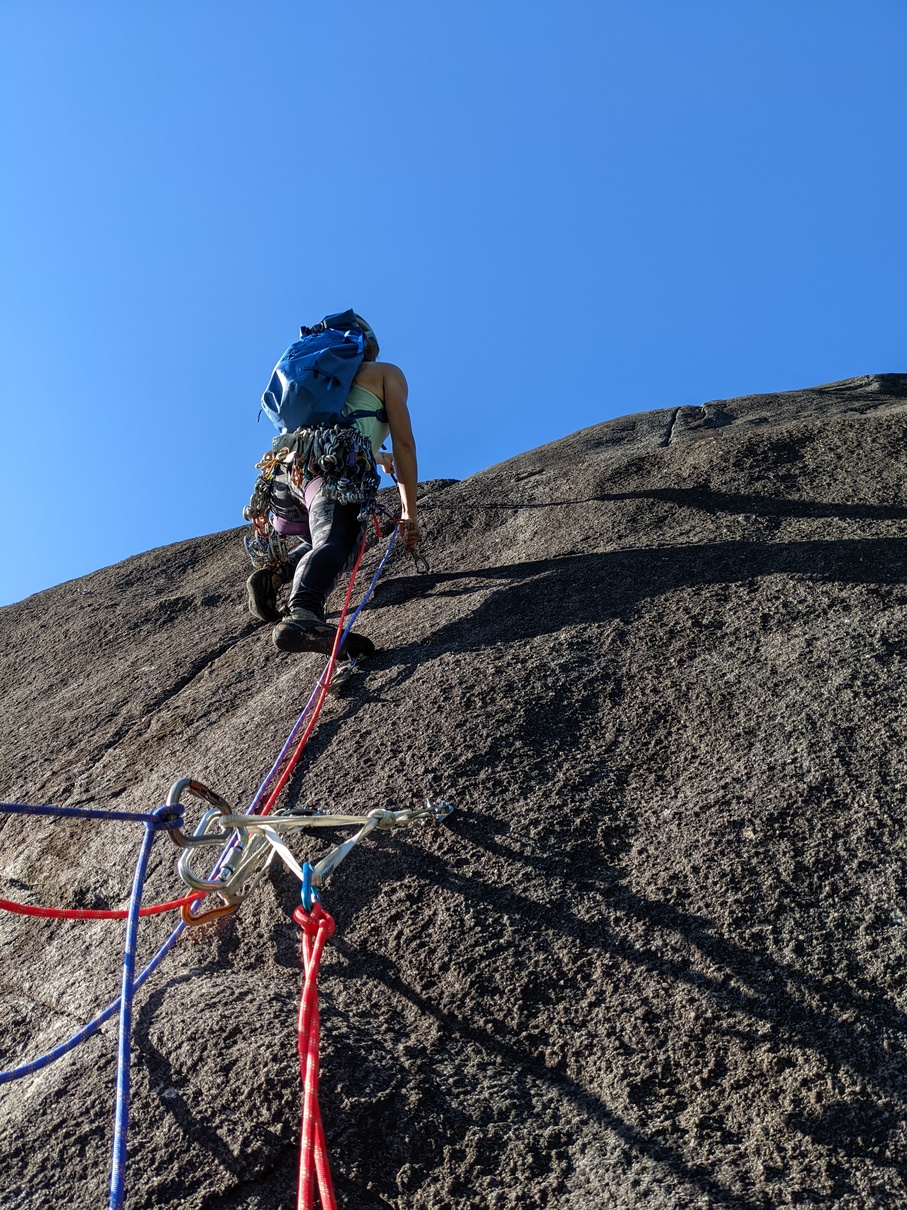 M leads
up a pitch of Into Light, before leaving Squamish.
M leads
up a pitch of Into Light, before leaving Squamish.
I’d been paddling almost all year, so I wasn’t worried about the boat section of the trip at all. Theres a single Class IV rapid on the entire 400 miles of water we were planning to do, and it looked straight-forward.
I did, however, need to climb a ton. Five out of six of us were planning to attempt the tower, and I was going to be one of two leaders on a three person team. I needed to have a strong mental game and good trad skills.
Luckily, M had a place up in Squamish from May to just before the trip, so I was able to get a lot of training in on Granite. I spent quite a few days out just putting in mileage. We also got to practice various new rope systems and gear that we would be using to slim down the amount of weight we needed to take up the wall.
I also did a lot of bodyweight work, mostly pull-ups and push-ups, just to try and put some endurance muscle on for the long flatwater sections. In hindsight I would have tried to run more, the heavy pack and long days definitely wore me down.
Testing
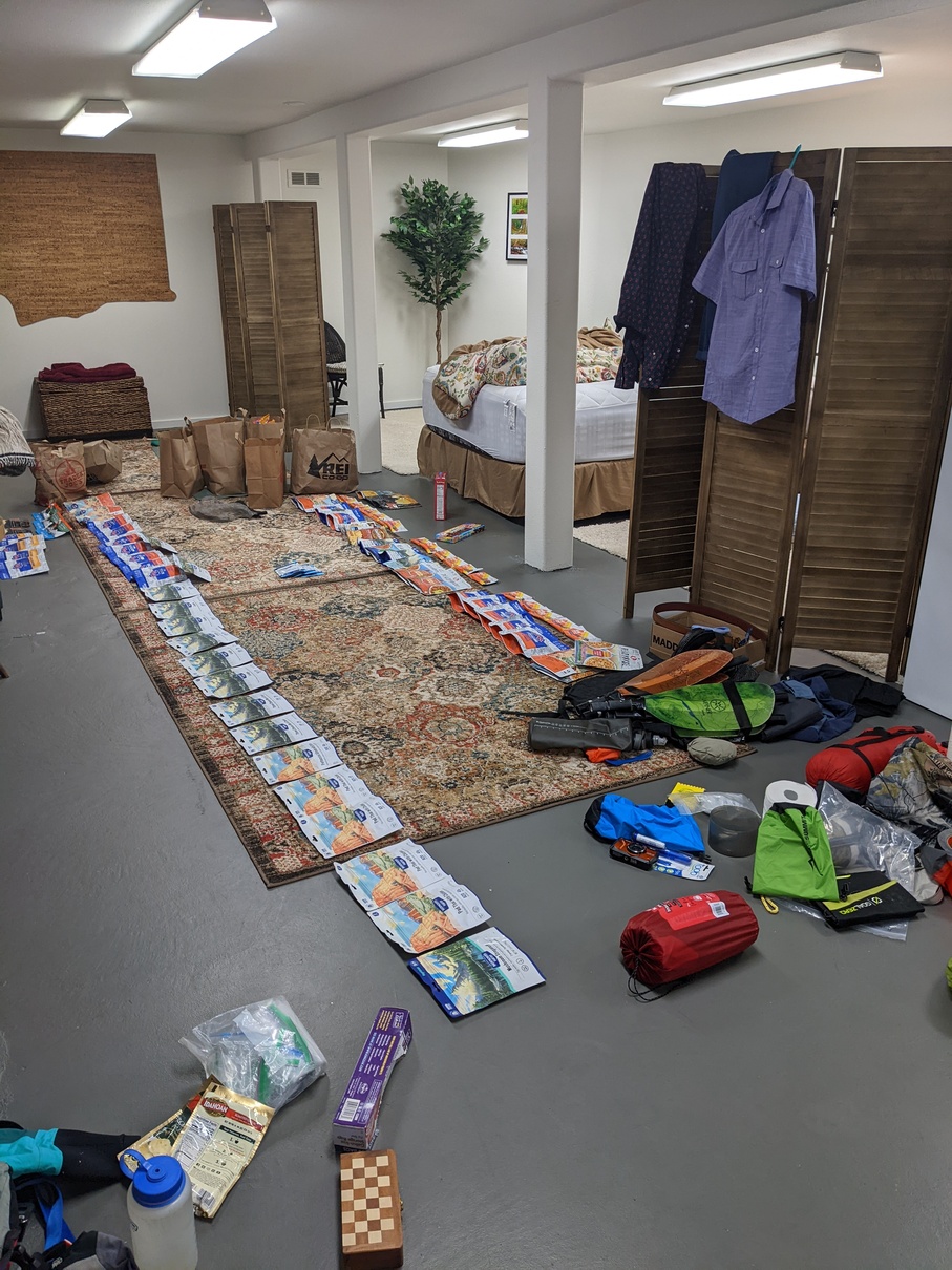 Laying out
food for 25 days
Laying out
food for 25 days
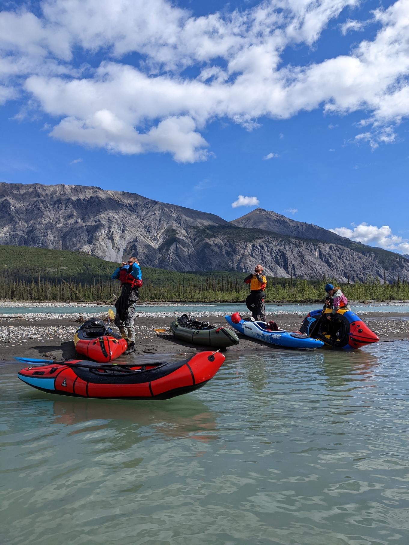
For once we didn’t have a whole lot of testing to do: The gear and food were either all going to fit in the boats, or it was going to be left behind. Whitney and Dirk were in hardshell kayaks, so they had a lot more test-packing to do than we did, but everything fit with no issues. The boats and backpacks were depressingly heavy (At least 50 pounds without boat gear for the first seven days) but not too bad considering we only had to hike with everything for about a kilometer, at the beginning.
Putting food together for 25 days (22 for-sure, 2-3 extra just in case) was a trask. M and I both would have taken more snacks, if we could, but we thought we were only allowed 200 pounds on the plane, and 100 of that was climbing gear, not leaving much for food. Luckily we found out later that we could bump it to 300. Everyone was pretty happy about that, as it meant less to carry in with us.
Trip Report
Day -2
We start the long drive North from White Salmon at around 5 AM on August 2nd. We drop off Megan’s brother and mom at the Portland airport and make it almost as far as Prince George sometime in the evening. A full day of driving. We listen to Season Three of Chameleon and binge the whole thing.
Day -1
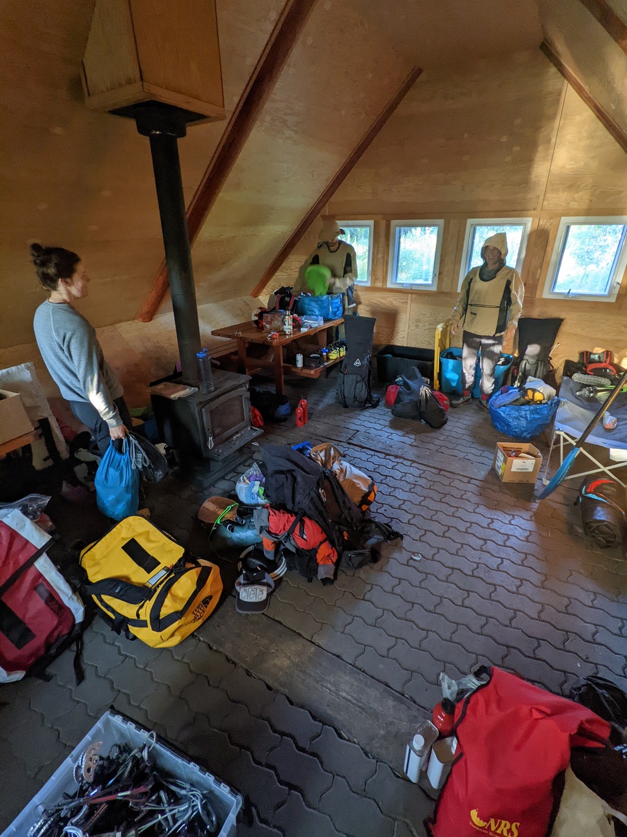 The
crew packs everything up in the cabin at Blackstone.
The
crew packs everything up in the cabin at Blackstone.
We make the rest of the drive all the way up to our take-out at Blackstone Territorial Park and arrive sometime in the afternoon. Everyone has some interesting wildlife sightings, we only see Bison but Dirk saw a lynx! The mosquitoes are already terrible, but the whole group is present by 9PM and we have a good time doing last minute preperations in the cabin we’d rented. M and I are the only ones to sleep indoors, everybody else either sleeps in vans or a tent. M and I are jealous of Mitch and Scarlett’s bug shirts.
Day 0
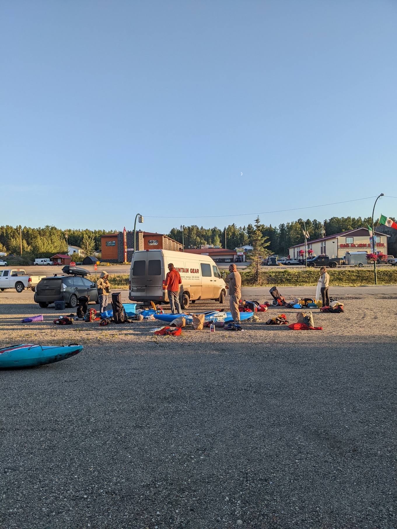 The final
packing session before leaving cars at Watson Lake
The final
packing session before leaving cars at Watson Lake
We leave two cars at Blackstone and pile into whats left: A prius and a sprinter van packed to the gills with boats and gear. I’m in the van with Whitney and we mostly discuss logic puzzles for the whole 10-hour drive to Watson Lake. We make good time despite the bizarre beaver-dam blow-out flood and subsequent hasty road reconstruction project on the Alaskan highway. Buying gas along the way is a novel experience.
We arrive in Watson Lake sometime in the afternoon and meet Quincy, who will shuttle us in to Flat Lakes, our starting point. We eat chinese food and buy last-minute shuttle snacks for the long ride tomorrow. At least none of us are driving now. The mosquitoes are only moderately bad, but they don’t seem to bother the true canadians so we try to limit our DEET usage and headnet hiding.
Everything is packed into Quincy’s trailer and we load up the kayaks as well. We camp outside Watson Lake at a campground.
Day 1
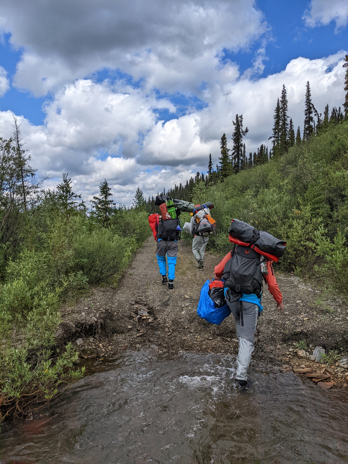 Hiking to
Flat Lake to finally get on the water
Hiking to
Flat Lake to finally get on the water
We start early, at around 6:30AM, and drop the vans off before piling into Quincy’s gas guzzler. Those of use that drink coffee don’t have any and we nurse headaches the rest of the day. Oops. It’s a fun five hour drive into Flat Lakes and we all chat the whole way. Some of us snooze. I am kind of sitting on a board or something and am uncomfortable the whole time. Everyone is astouned by the quality of the sandwiches from the grocery store: they’re amazing. M kills a whole container of hummus.
We finally make it to the put-in, and we all immediately hide in mosquito nets and bugshirts and drysuits. Everyone manages to pack their bags and we’re off, saying goodbye to Quincy who has a full day of driving ahead of him. We leave him dumping gas into the car and start our hike into Flat Lake proper. 40 hours of driving, finally done.
It’s a short kilometer or two to where we can actually inflate boats and put them on the water. The backpack, food and boat gear all feel very heavy so I’m glad to be sitting on top of them instead of carrying them. M snaps a few “before” portraits of everyone so we can do a good ol’ compare and contrast at the end of the trip.
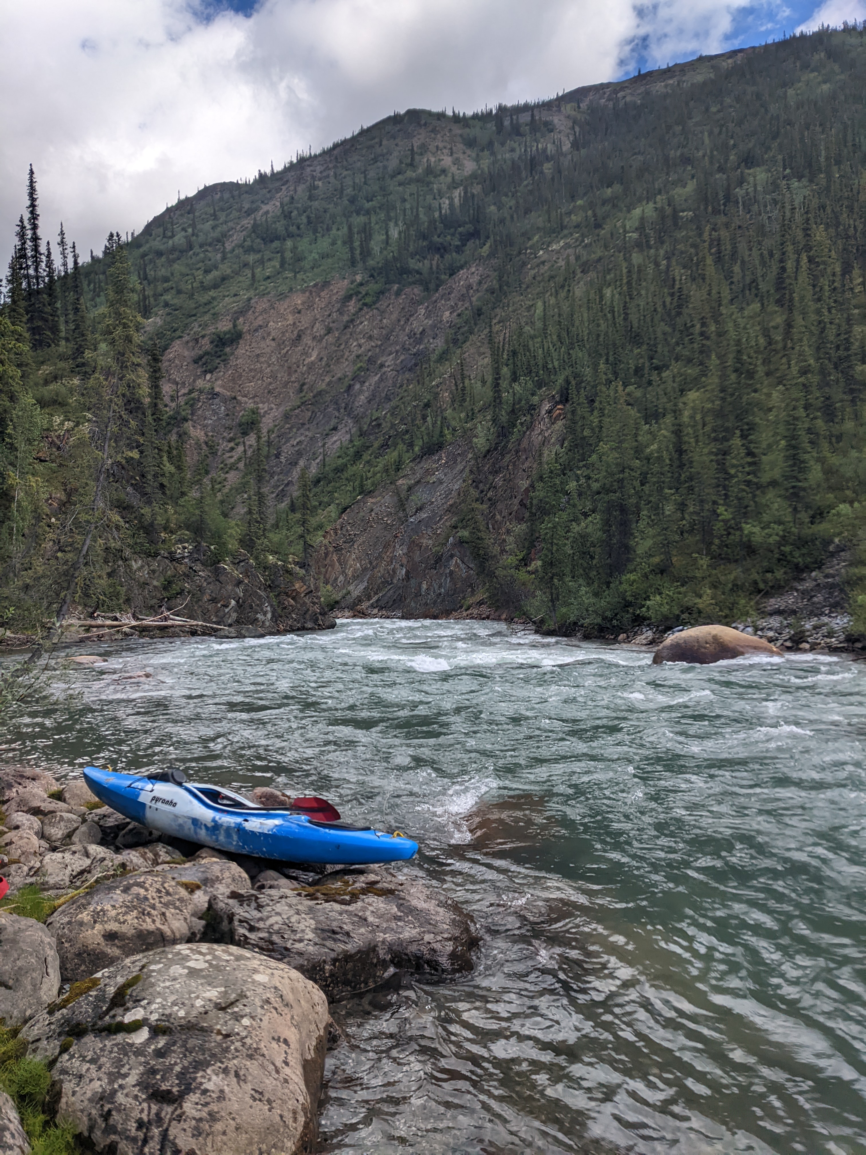
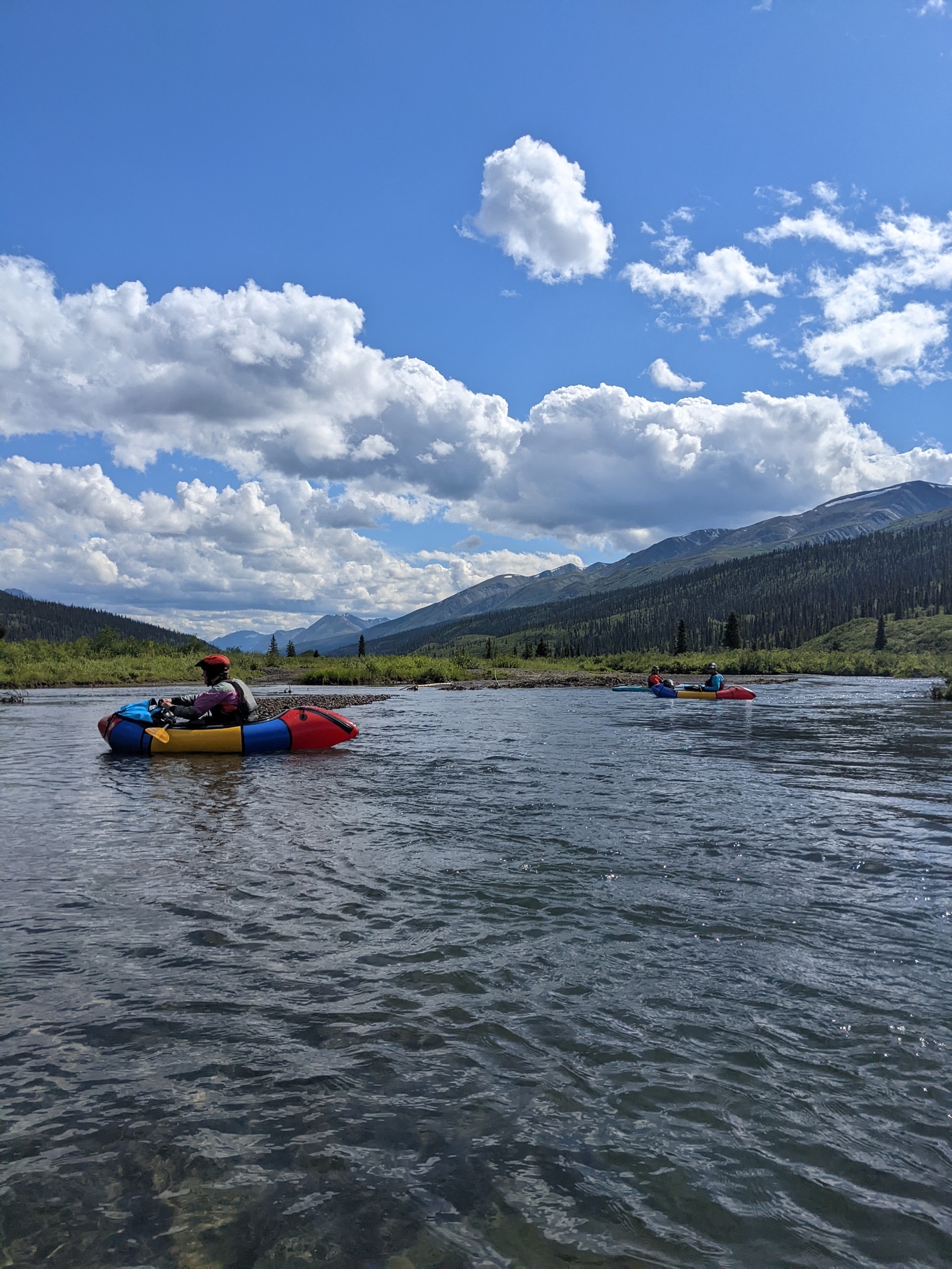 Floating
on the Little Nahanni just after Flat Lake
Floating
on the Little Nahanni just after Flat Lake
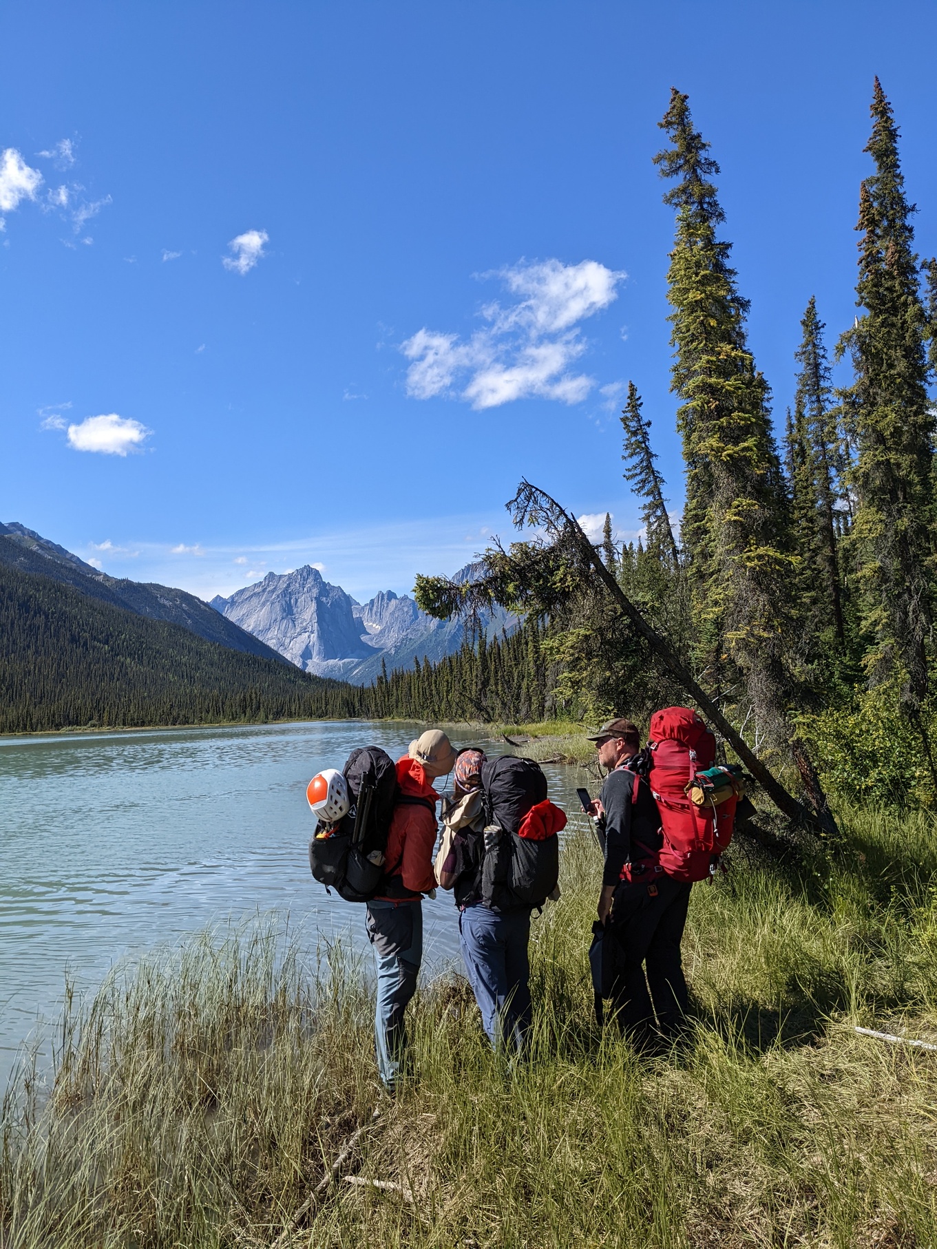
And we’re off! It’s an easy paddle across the lake that lasts a good hour or so. I surprise myself by getting a good roll off in the Valkyrie- I find it’s a lot easier loaded to the teeth with gear. A good start to the trip. We continue along meandering, grassy, clear water until rocks start to appear. We see a bear up in the trees and a couple of birds. This whole meandering section takes a lot longer than any of us expected, so we’re hungry towards the end of it. M gives me a packet of tuna, and Mitch gives me a strange bar that does the trick until we get to camp.
We make good progress and eventually theres some actual whitewater, mostly rock bashing and small boulder gardens. It’s fun and we’re happy to be moving through the water with some current. The kayaks have less fun, since they’re both super long and very heavy.
 Our gravel
bar camp at the end of day 1.
Our gravel
bar camp at the end of day 1.
After a full day, we pull into a campspot marked on our maps from some random trip report towards the end of the Staircase rapids- they’re noted as class III but there wasn’t really anything to worry about. I bet in canoes they’d be more of a handful. Camp is more or less pleasant, with some old bear tracks, good tent areas and some good places to stash food. It begins to rain on us after we all eat dinner and unpack so we go to bed.
Day 2
 A random
break spot in the sun
A random
break spot in the sun
It rains on us a little bit and the mosquitoes are annoying, but otherwise we break camp and move on. We establish our 9AM depart schedule, which we more or less stick to for the rest of the trip. We finish off the Staircase rapids for the day and move through easier, slower water for the next few hours. The sun comes out and we all enjoy it.
We had gotten a tip via our airplane pilot that another group had reported a bunch of wood in the river, so we were apprehensive about it, but we had almost none. Later we’d learn that they actually cut out and removed some, but we had a very easy time.
At one point we get a good look at a bear who had come to the water’s edge to do whatever it is bears do. He got up on his hind legs and got a good look at us before we rounded the corner. Very cool and the closest we’d get to one on the trip.
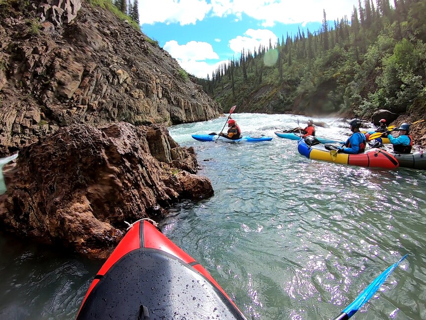
 Looking
into Crooked Canyon
Looking
into Crooked Canyon
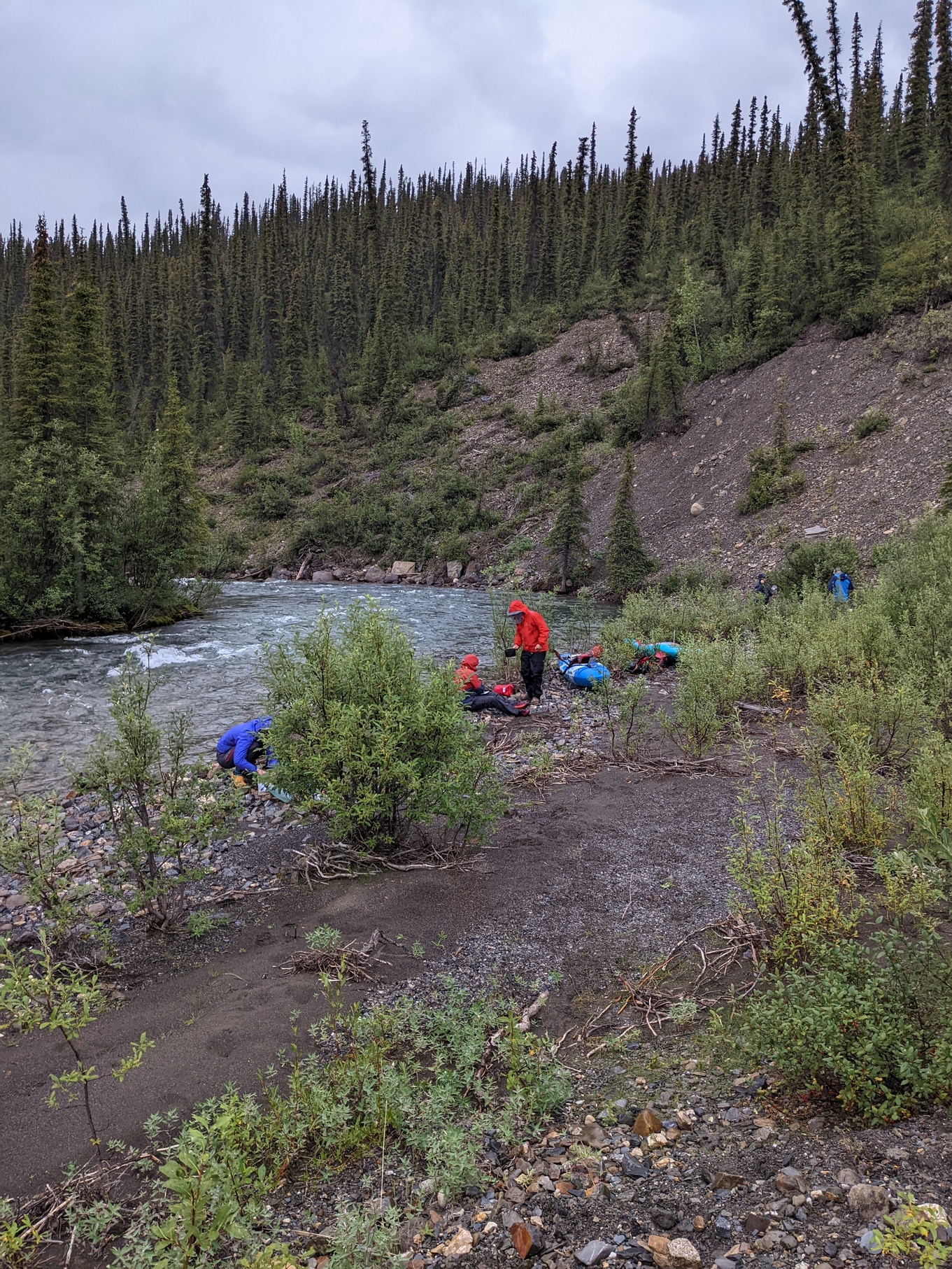
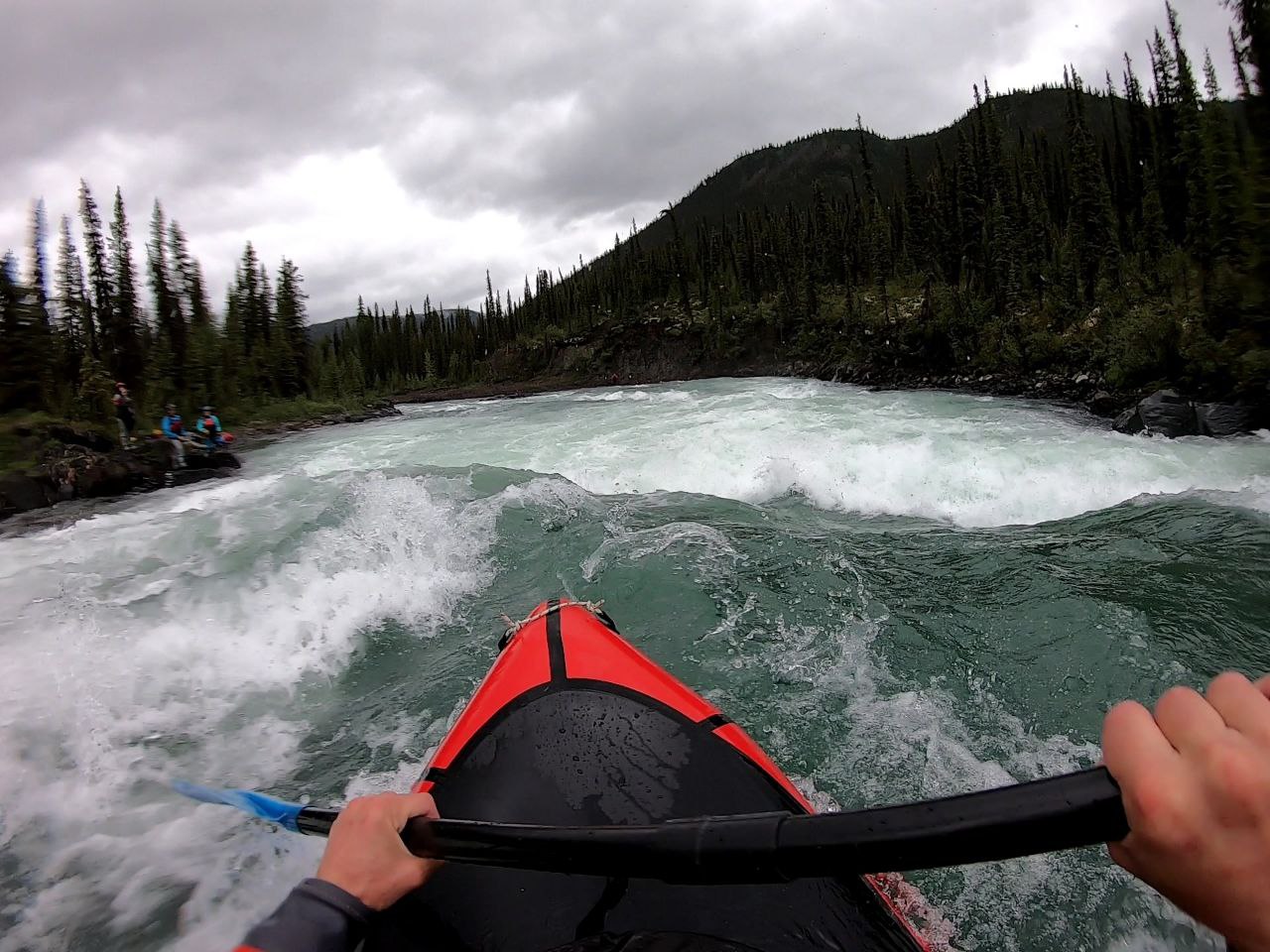
Later in the day we arrived at crooked canyon, one of the stouter sections of whitewater on the Little Nahanni. We all got out to scout and make last-minute decisions, and we all decide to run it. The whitewater looked fine at the mouth of the canyon and we weren’t too worried. I was pretty excited.
It was a fun, splashy section with some interesting moves but nothing too difficult. We had one swim but it was a quick recovery. The only complication was some wood in the final rapid that we had to go around.
 Whitney
exits the eddy after we all portage around some submerged wood
Whitney
exits the eddy after we all portage around some submerged wood
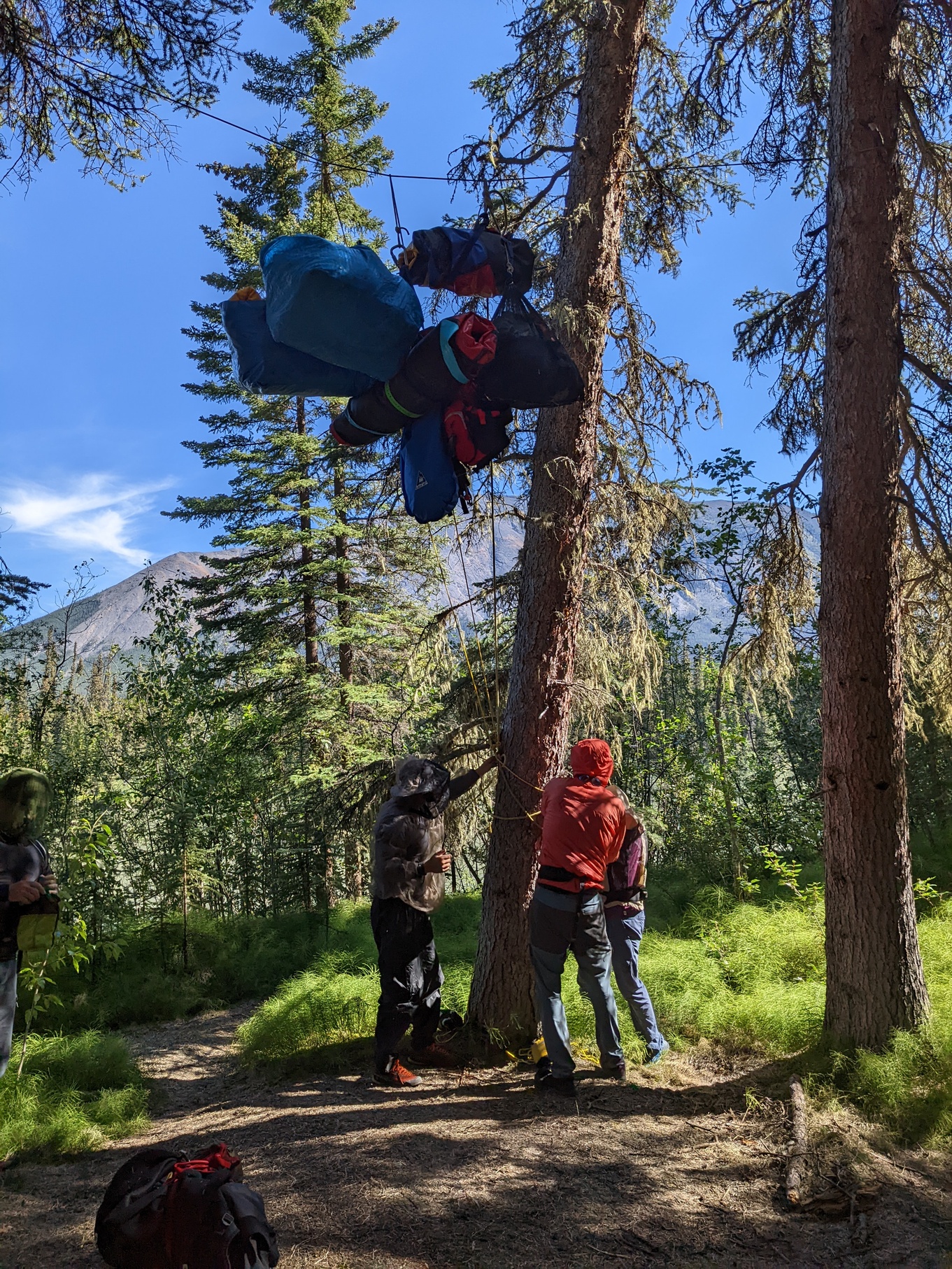
We all make it to camp after around 23 miles. M and I continue down to the actual confluence to camp on a slightly different beach than the rest of the team, no mosquitoes and quite wide. We spend the evening playing with rocks and figuring out our goofy bear hang. It’s a fun, easy day with good weather and we enjoy it a lot.
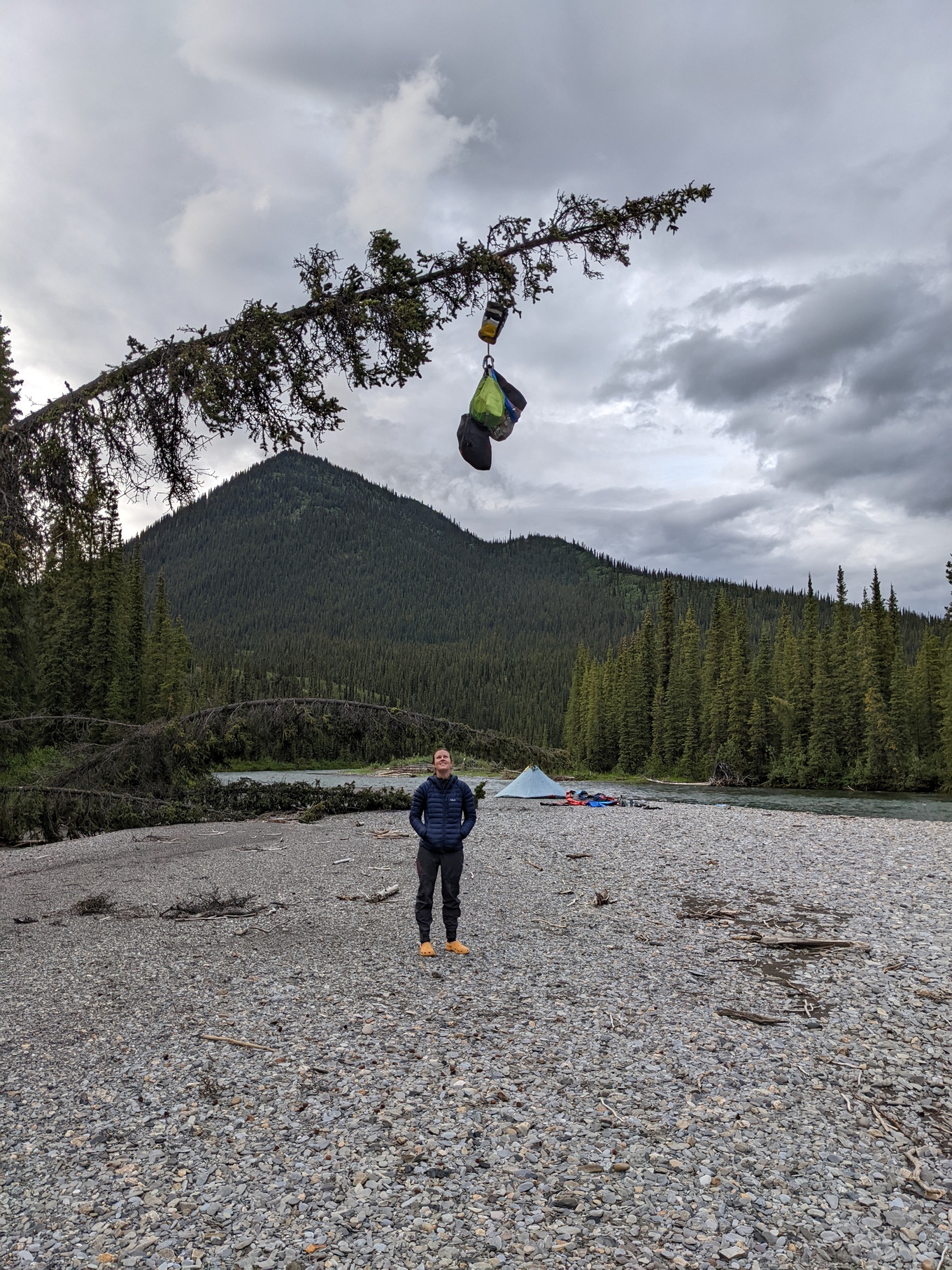 M looks at
our bearhang, which Mitch compares to a catapult when the tree is fully
loaded
M looks at
our bearhang, which Mitch compares to a catapult when the tree is fully
loaded
Day 3
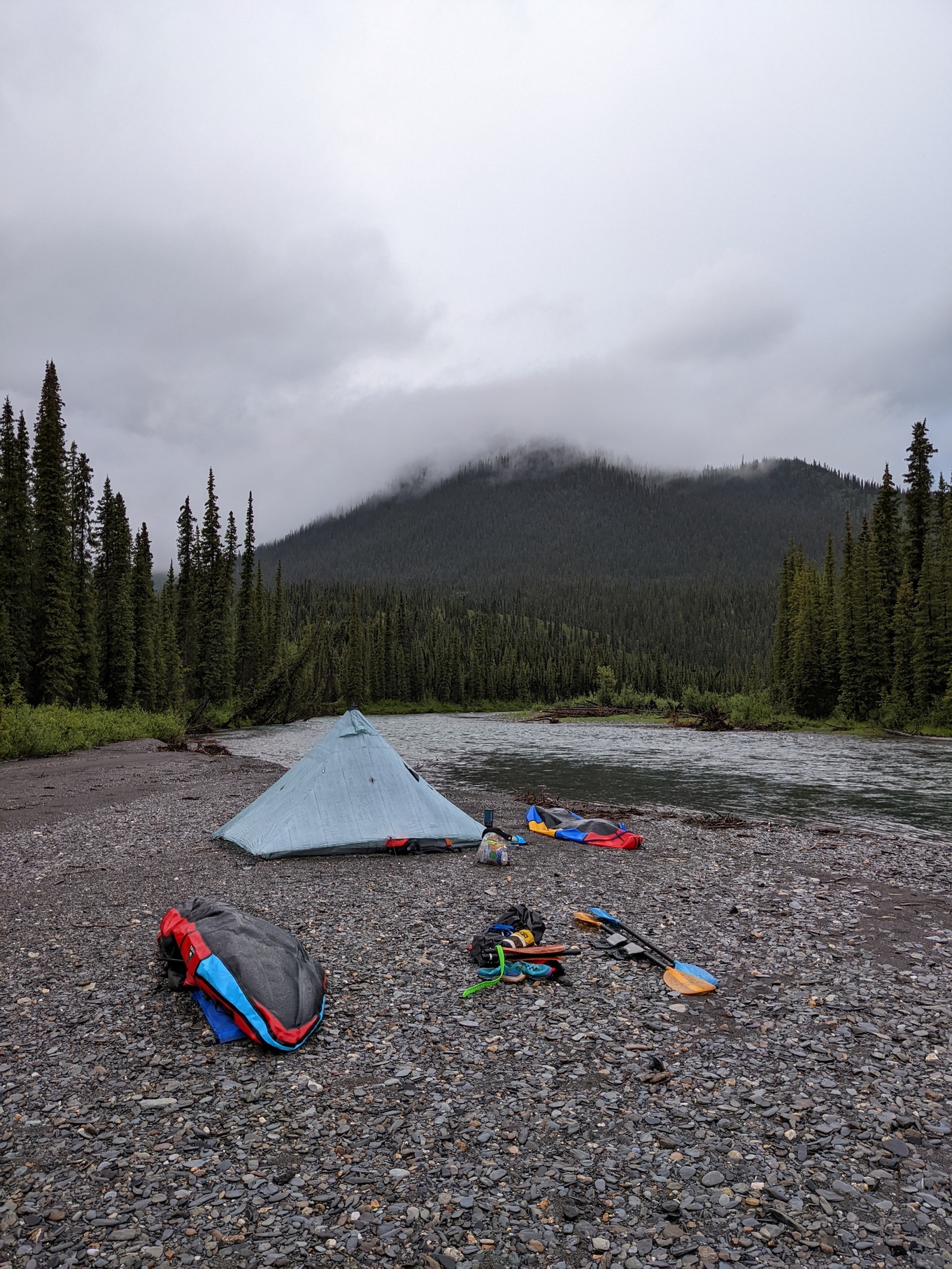 Camp just
after we woke up on Day 3
Camp just
after we woke up on Day 3
It’s overcast but not particularly rainy when we make our way out of camp. We roll more or less right at nine past the confluence with Steel Creek and keep moving. We make pretty good time. It’s pretty fun, easy rapids all day until we get to The Step, which looks absolutely huge compared to what everything else has been.
It’s a Class IV rapid that we discounted because the only video we found of it online made it look miniscule. Standard GoPro effect: In person it’s a significant drop with recirculating current on either side of a straight-forward tongue. Easy to get right with bad consequences if you dont: You’d be in there for a while.
 Just about
to plunge over The Step
Just about
to plunge over The Step
Everyone portages except Whitney- his line looks good so I decide to follow it. It goes well. M wishes I hadn’t talked her out of it. I’m pretty psyched. More fun whitewater, and then we eventually get to the confluence of the Little and South Nahanni rivers.
We pull a pretty big mileage day and swing by the Moore Cabin after some difficulty finding it and are absolutely SWARMED by mosquitoes, the worst we’ve seen thus far. We get out of there in a hurry and they actually follow us downriver for a while, we’re all have headnets on. It’s brutal. We decide to pull a big day and hit up Moore’s Hotsprings just downstream.
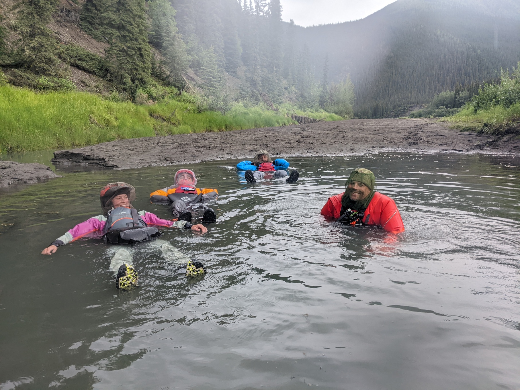 Soaking in
Moore’s hot springs
Soaking in
Moore’s hot springs
At first we’re worried because we can’t find them, then we realize the pool of water we’re standing in is actually warm and we’re pretty stoked, so we declare it the campspot. Everyone gets into the hotsprings in their drysuits and we have a good time.
The mosquitos are still bad however, and it rains a bit, so it’s not the best camping ever. After dinner, I hide in the tent while everyone heads over to the springs. It’s kind of miserable hunting for mosquitoes in the tent when you know they’re somewhere. You never really get all of them and they like to bite your hands and face while you sleep.
Day 4
 Taking a
break at the Broken Skull confluence on day 4 after the weather
clears
Taking a
break at the Broken Skull confluence on day 4 after the weather
clears
Probably the most miserable day of the trip for me. It’s raining, everything is wet, and the mosquitoes are terrible. A full tree floats down the river next to our camp before we leave. Good signs? Maybe?
M somehow manages to miss the morning wave and poops out in the woods with no issues, everyone else has various horror stories of a dozen new bites on private parts. I decide to hold it and just hope for the best. I spend the whole morning being grumpy and alone at the back of the group on the river. M improvises a vapor barrier for leaky drysuit feet out of two ziploc bags.
Despite my bad attitude, everything is beautiful and it’s a fun float. The whitewater is more or less over for the trip, so we all just settle into the flatwater paddling rhythm. There are a few easy rapids just for something to do along the way.
The Broken Skull confluence is very pretty. We hang out for a little while where the waters mix and Whitney sets off a bear banger in celebration. They’re neat little things, kind of like mini flares.
 Our camp
at the end of day 4
Our camp
at the end of day 4
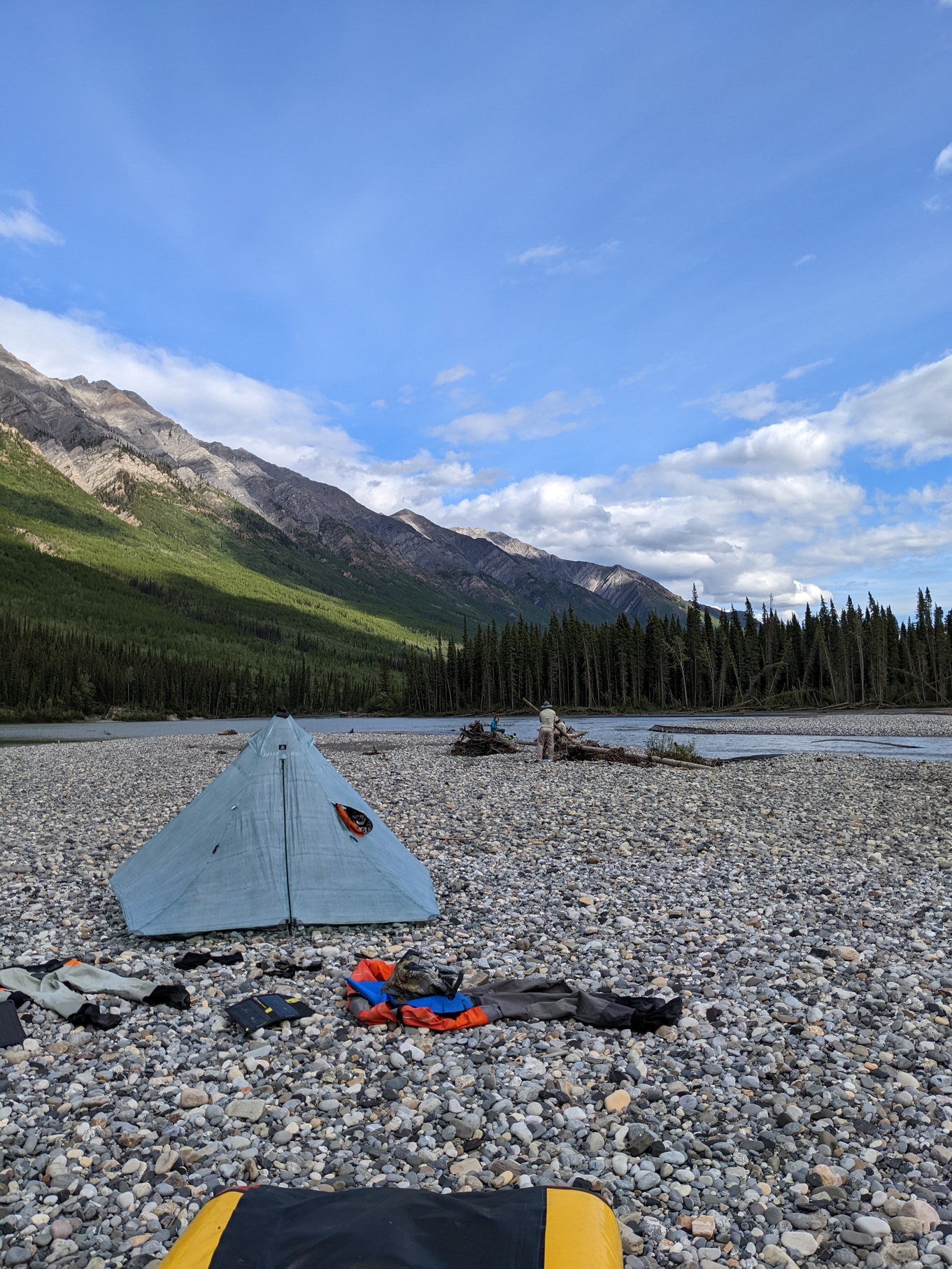
We find a pretty amazing campsite later, the sun comes out, and we all hang out on the beach. We spend a lot of time skipping rocks and some time playing chess. I find an amazing ammonite fossil at the end of the day which kicks off a rock frenzy.
Day 5
 Approaching Glacier Lake, looking at the Cirque of the
Unclimbables
Approaching Glacier Lake, looking at the Cirque of the
Unclimbables
Since we pulled a longer day on day 4, it’s only a short paddle to the take-out for the Cirque of the Unclimbables approach. We paddle for a couple hours, then find our spot near an old snye in the river. There are bear-hang wires and trail signs, so we’re marginally sure we’ve found the right place. There were several different stories and conflicting waypoints on the map, so picking the one with actual trail blazes seemed like the best bet.
 Figuring
out how to hang our boats
Figuring
out how to hang our boats
After much wrangling with our gear, we load up packs, hide from the mosquitoes and begin hiking onto the swampy trail up to the cirque. It’s hot and takes a good amount of time. My pack feels heavy, even though I know it’ll be way heavier once we get our food cache. From previous trip reports, we’re not sure if there will be paddles with the canoes we expect to find at the lake, so we bring some breakdown kayak paddles just in case.
Brintnell creek looks absolutely incredible on the way up, and Whitney and I both contemplate dragging boats up to run it. Real Class III/IV whitewater!
It takes a while to get to the canoes, but we do eventually. It’s three miles across the lake, the weather is beautiful, and it’s pretty awesome to be approaching the cirque. The towers and peaks just keep getting closer and bigger. It is, however, difficult to paddle two people in a canoe if you’ve never done it before. The boat steers like it’s drunk. I’m frustrated the whole time but we make it.
We enjoy the good weather and two of the park’s red chairs, right next to the park cabin, and are thrilled to be reunited with our drop bags full of extra food and climbing gear. The packs are going to be very heavy, but that’s tomorrow’s problem.
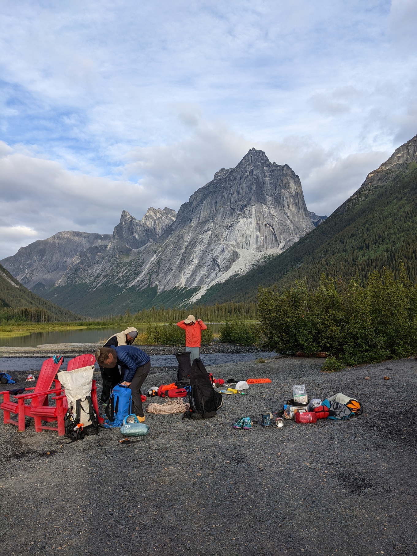 Getting
ready for the approach
Getting
ready for the approach
Next up: The cirque, fairy meadows. To be continued.
