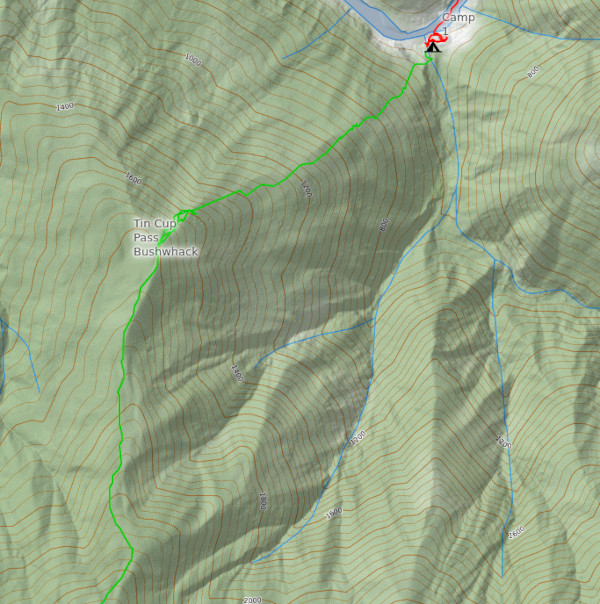
Tin Cup Creek
Watch the video here
Quick shout out to Sockdolager Equipment for providing a pack, pogies and my personal favorite, the tri-tip inflation adapter.
Background
Tin Cup Creek is an unpaddled tributary of the Chetco River in the Kalmiopsis Wilderness of southern Oregon. It’s access is both unmaintained and extremely difficult, which is why, until now, no one has gotten in there to check it out.
Depending on what map you are looking at, a trail exists branching off from the Chetco Divide trail and going up Tin Cup Creek proper, but in my communications with the Siskiyou Mountain Club no one has actually worked on that trail for a very long time. In the Kalmiopsis this means it might as well not exist, due to fires and the general rugged nature of the area.
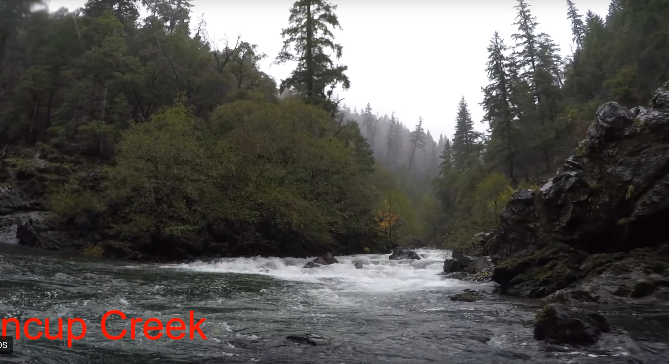
 One of the only images I was able to find, from the Siskiyou
Mountain Club
One of the only images I was able to find, from the Siskiyou
Mountain Club
The only two logical ways to get in there, then, are via the Illinois River (and the mysterious “Tin Cup Pass”) or to do a big overland day on the Kalmiopsis Rim Trail and drop into the headwaters somewhere. The only drawback with this is the awful bushwhack up and over the pass from South Bend: It’s steep, very dense and completely unknown.
 Austen pans across the confluence with the Chetco in his excellent
video
Austen pans across the confluence with the Chetco in his excellent
video
I’d been chatting with various people for a few years now and haven’t been able to make it happen, until I finally linked up with Jacob Cruser on the Minam River last year and we started talking about it. He’d actually attempted this same route years before with hardshells and given up, so he was really the only other person in the world that knew anything about this route. I’d emailed him in my various campaigns before as well, so I think he knew I was serious about it.
 My own visit to the confluence last year on my Chetco
trip
My own visit to the confluence last year on my Chetco
trip
One handshakey agreement later on that trip and we agreed to go for the logical Illinois River -> Tin Cup Creek -> Chetco River triple. If anything, it would be a cool link up and a first descent. How bad could the bushwhack be? The mystery compels.
Day 1
 A rapid on the Illinois, photo cr. Jacob Cruser
“I think it’s going to be six miles of Conehead.” - Jacob, musing on the nature of Tin Cup Creek before seeing it.
We met up the night before and camped out at one of the standard Chetco River take-outs, the bridge. It had been kind of cold and we were fully immersed in a fog bank. It would be a theme: lots of moisture.
We left soonish after waking up and drove straight to Gasquet where we picked up a shuttle driver. He was very chatty, doing quite a lot to diminish our apprehension about putting on the Illinois at ~3500 CFS.
Sadly, I shot quite a bit of GoPro during our Illinois descent, but the discount SD card I bought died. I wasn’t able to recover anything off of it. Never buy the returned SD cards from Fred Meyer! We were pretty conservative given the nature of the trip. It was good fun, and all lines went well.
We pretty much snuck every rapid: Shout out to the Whitewater Guidebook page on the Illinois and some phone-beta our friend Jim sent us. The mileages were super accurate and the descriptions were great.
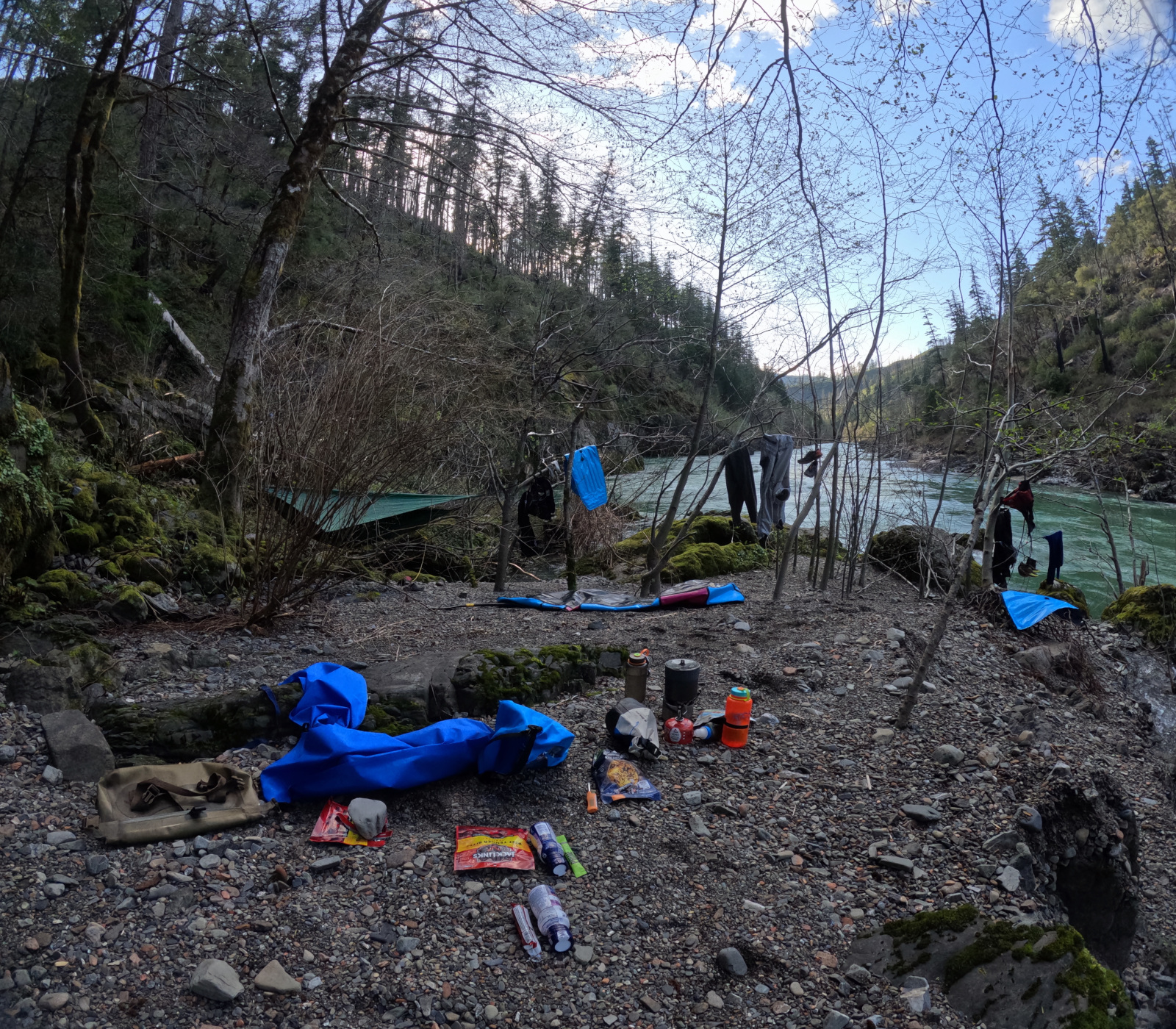 South Bend camp
We were able to camp right at South Bend, a good ways above Green Wall, and scout out the start to our “hike” a little bit. We spent the evening swapping stories and drinking a little whisky.
Day 2
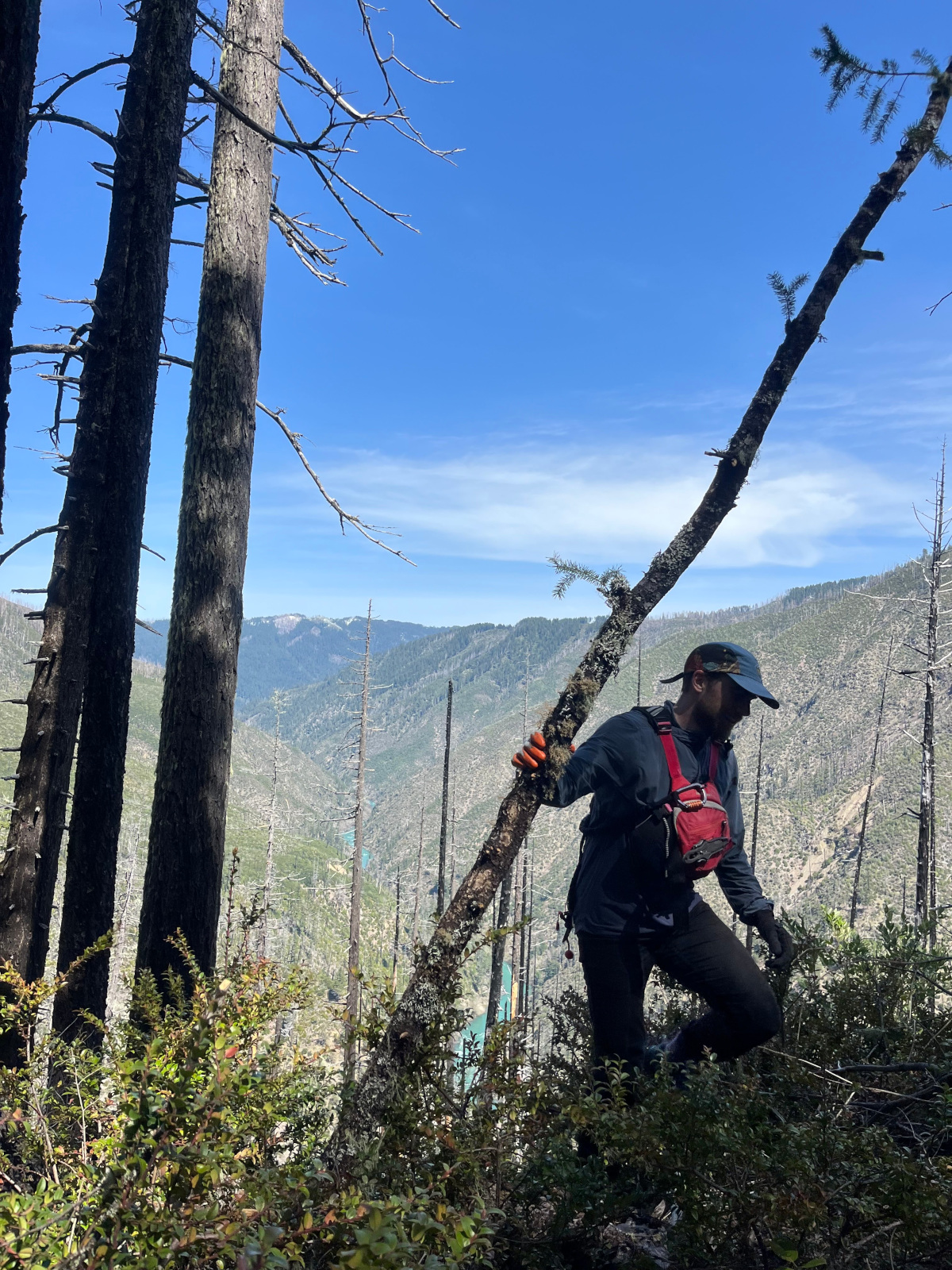
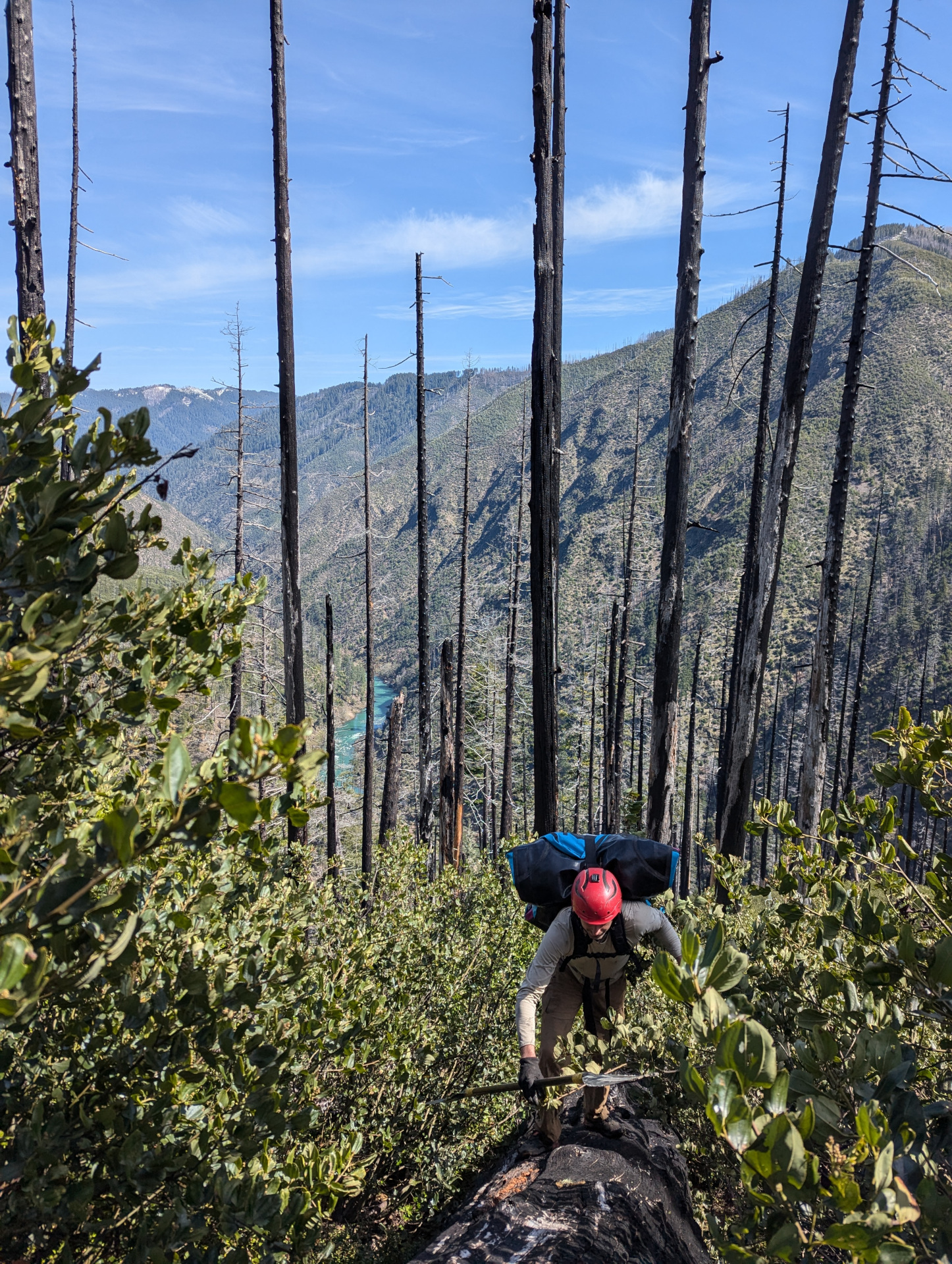 Jacob takes an opporunity to stay above the foliage
Neither of us slept super well: cold and wet. Back in the cloud. We ate and packed up, leaving around 9.
“Have you read the Long Walk? It’s very compelling.” - Jacob, at one of the comically small rests we found in the brush.
There wasn’t much to say or do other than to just get to it: It was horrible. I immediately tried to lead us into Poison Oak, which wasn’t blooming yet, but Jacob knows the stuff very well and always steered us straight.
 Jacob saws through a stout little set of branches
I’d picked up a lightweight pull-saw from Suluk46 just for the trip, and it proved invaluable: if anything, just to stop and do something other than grovel with a giant backpack on.
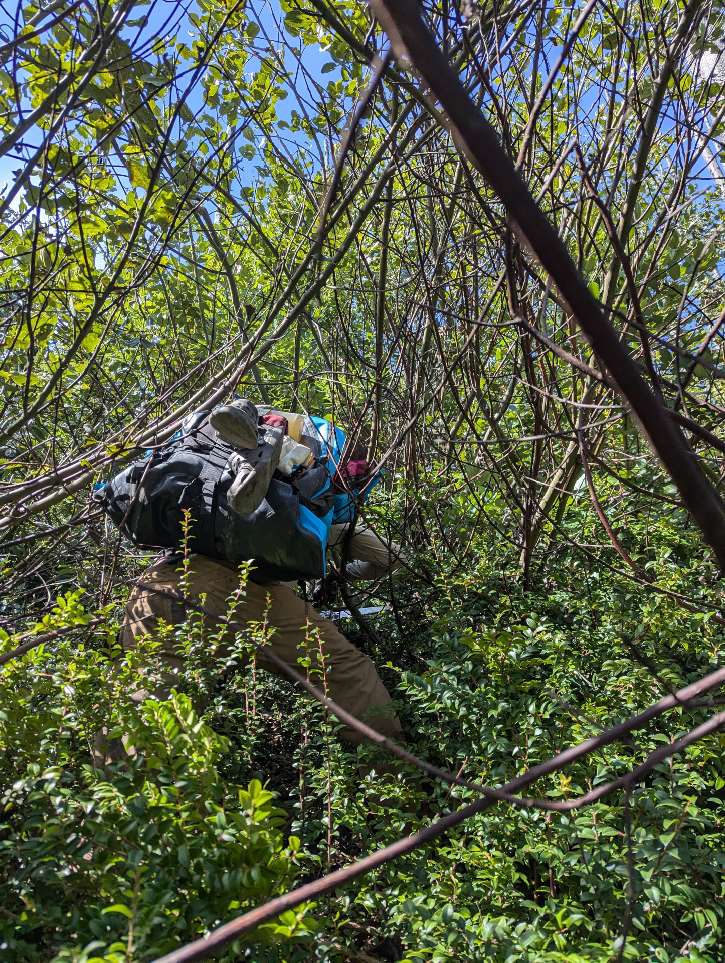
 Exasperated at a rest point
It took us four hours to cover the next half-mile, and about a thousand feet of elevation gain. The path was winding, tortuous and impossible to see. We would fight our way up through steep, crumbling dirt and through very tight bushes into poison oak infested pods which we would try to move around. 1 liter of water was not enough. Every now and then we would sit in a small, rounded out clearish area next to a burned tree and rest. It was very slow going.
Eventually we made it to leveler, clearer ground at a sort of plateau, where I discovered my PFD had come off somewhere in the bushwhack. I didn’t think it would be too far from the top, so off I went back down the hill. It took me 40 minutes to find it, but I did.
 Re-cresting the lip of the plateau after rescuing my life
jacket
Re-cresting the lip of the plateau after rescuing my life
jacket
From there it was a little easier going up until the very top of the pass, but not much. We were kind of wasted and I was definitely dehydrated. Lots of cramping. We briefly celebrated with a snack up at the crest of the pass and then started picking our way down. A small spring helped us get back on top of the dehydration spiral.
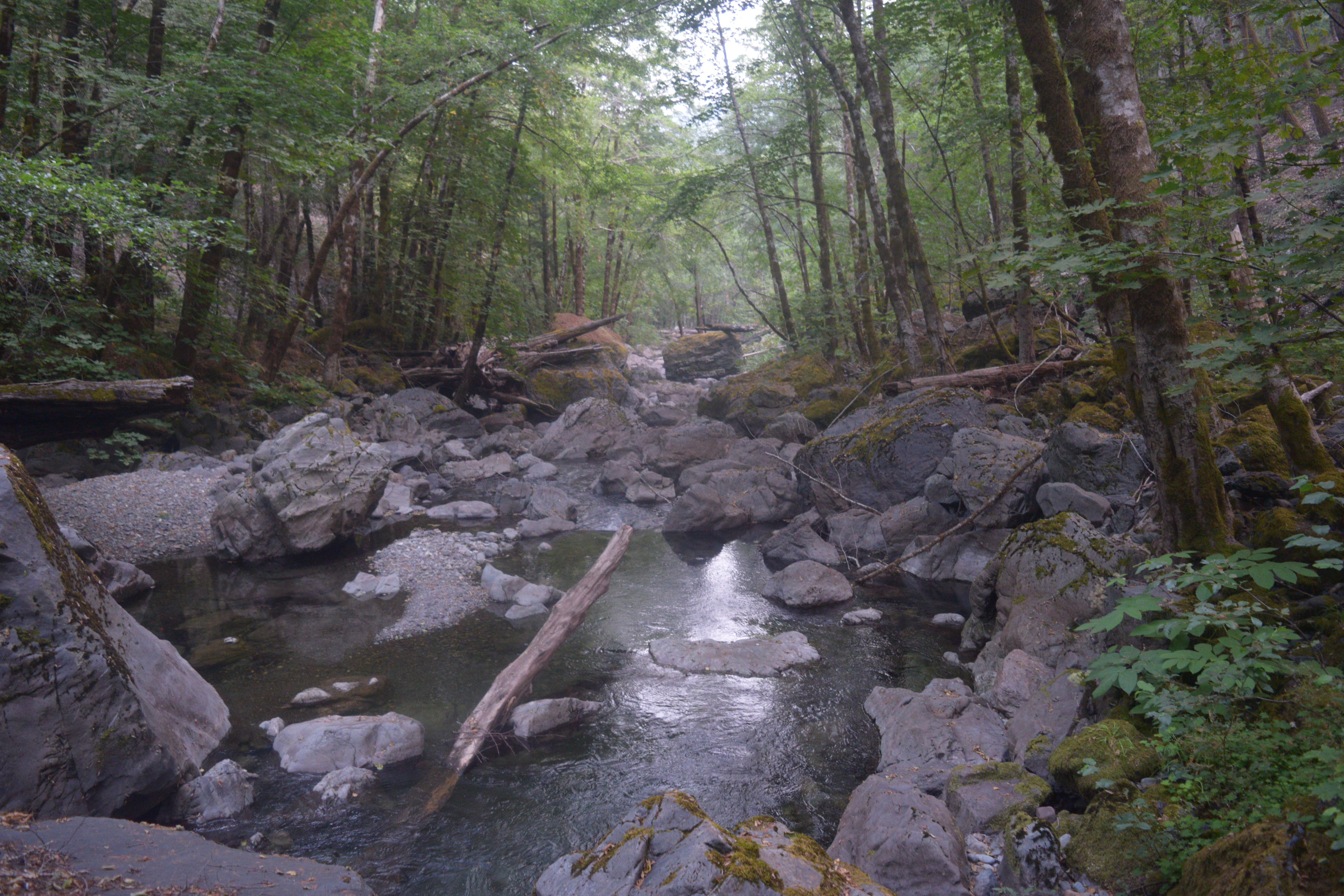
The backside was better, but there were thick sections of madrones that really slowed us down: just standing completely on branches and falling through trees to try and gain a few feet was the name of the game. Eventually we were able to make it to the creek: A very welcome sight.
There wasn’t much of a campsite, so we had a little coffee paste, ate some snickers bars and inflated our packrafts. We carefully scrubbed everything down with soap, because the contact with poison oak was inevitable. Everything sacrificed to the bushwhack went into drybags and stuffed deep into the boats.
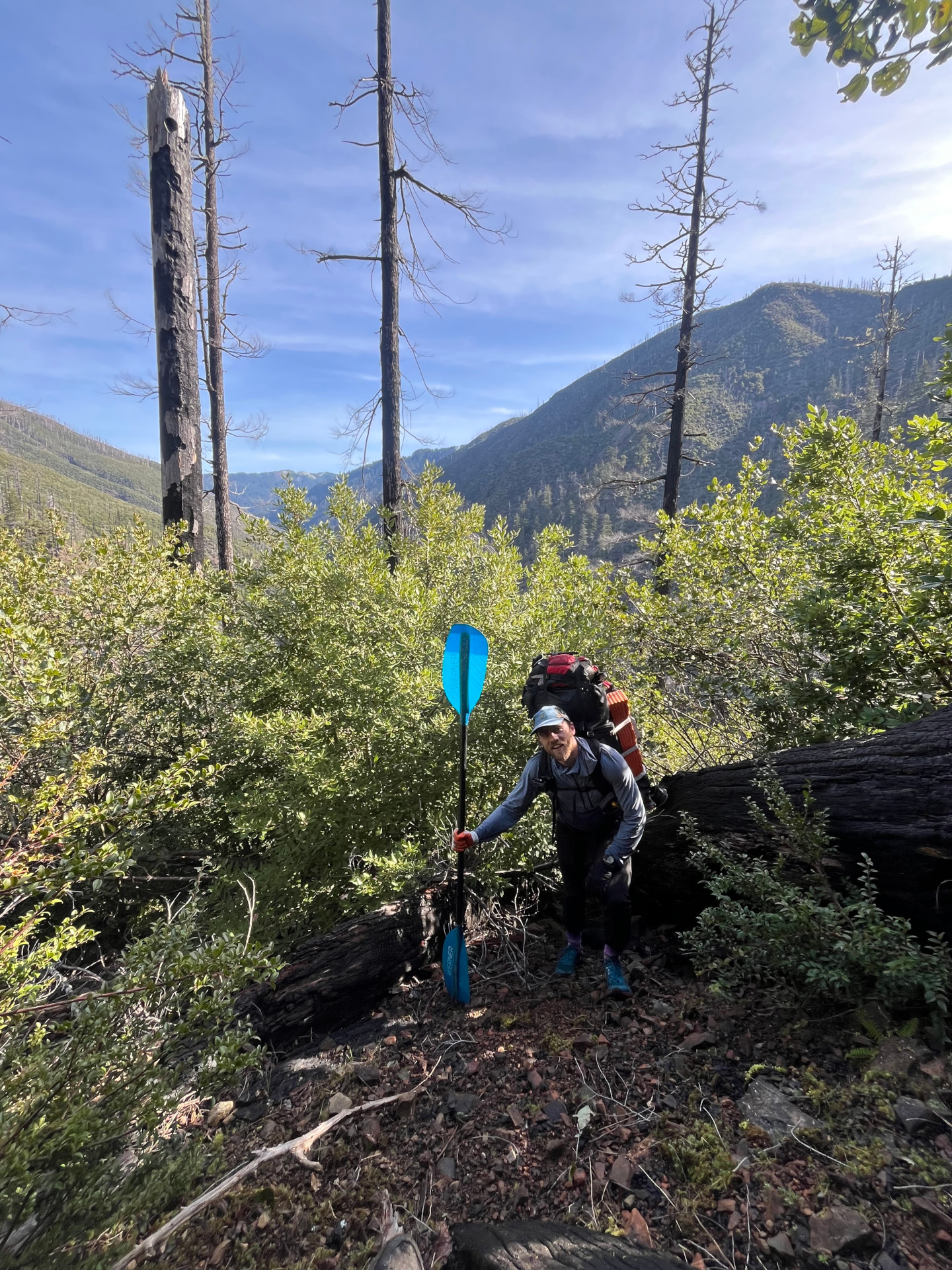
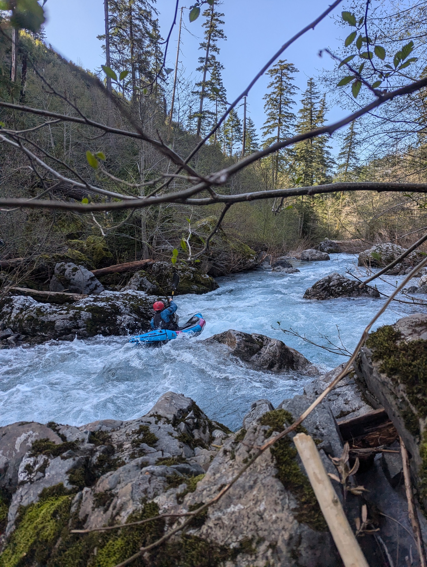
 High hopes
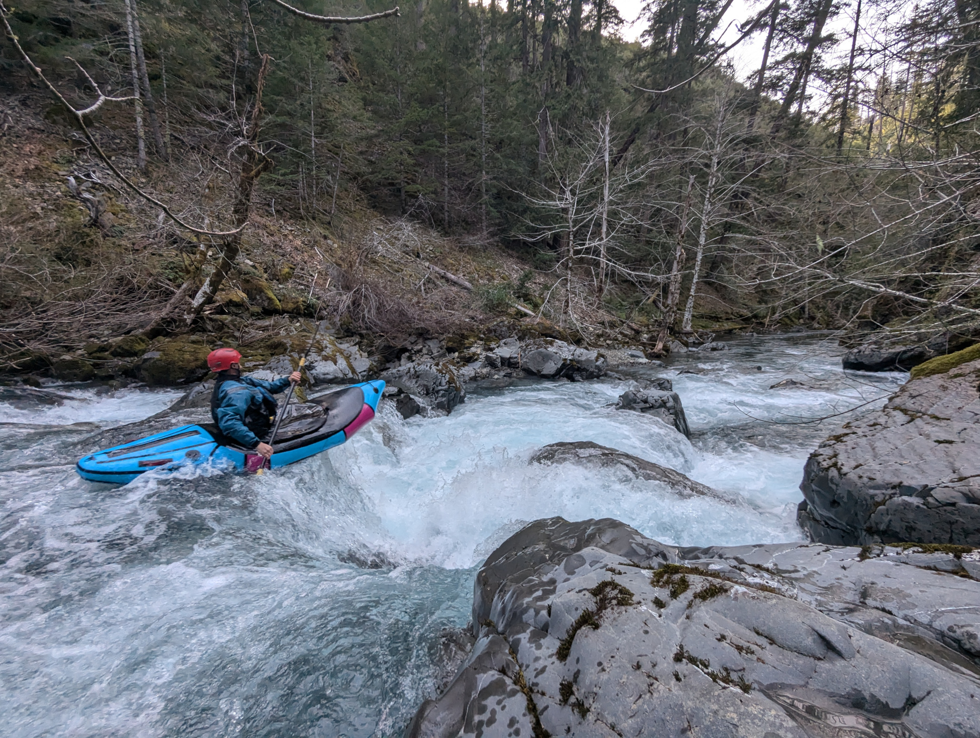
We had just enough water, and were able to pick our way down. After a portage at Heather Creek (big log jam!) we found a nice boof, pictured above. I wasn’t sure about running it given how tired and beat up we were, but Jacob is more experienced in these things and pointed out it might not be runnable in the morning. We gave it a go, and it was amazing.
A few more bedrock rapids later and found a nice, giant camp that would work for both of us near a waterfall. It didn’t take us long to fall asleep.
Day 3
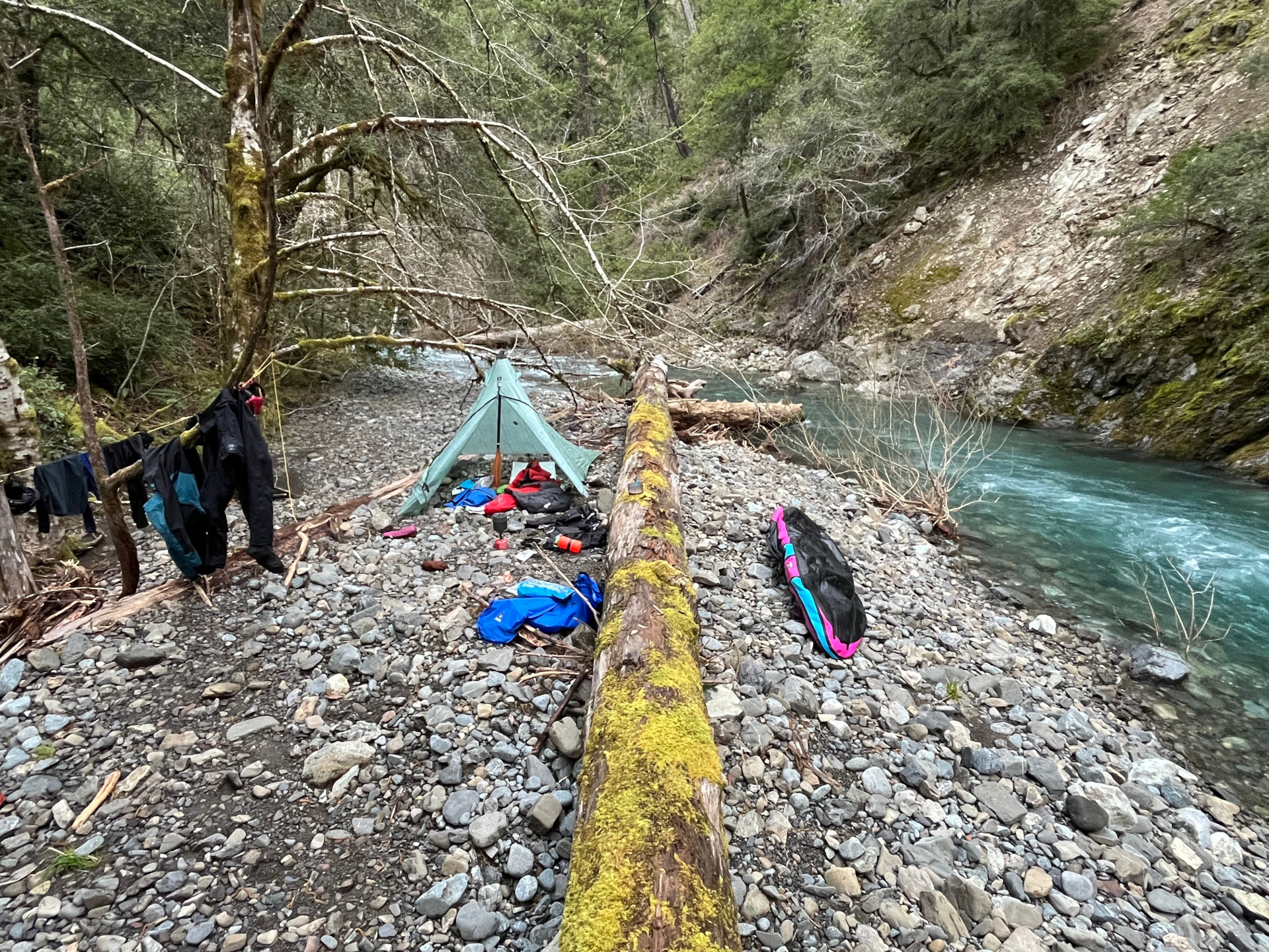 Tin Camp, photo cr. Jacob Cruser
We were lucky and slept a lot warmer. Jacob tried the ol’ Alpine Nalgene-full-of-hot-water trick and I guess it more or less worked out for him. We weren’t particularly fast out of camp, but we still managed to start inflating boats just before 9AM.
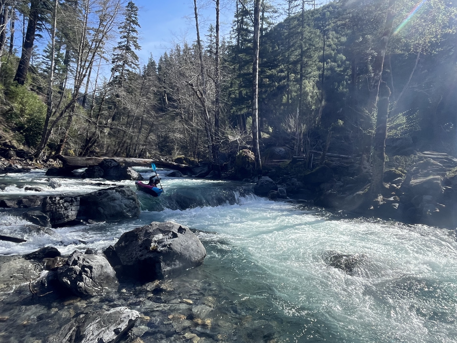
 A nice boof mid-rapid, higher up
Our first section was definitely different than the evening before, it opened up and more wood was present. We had okay-lines through some marginal rapids, and did a couple portages around strainers. There was an incredible ~5-8 foot boof that would have been really sweet if it hand’t been for the tree stuck in it.
 Boofing a nice ledge on a higher quality rapid before the step
section
Boofing a nice ledge on a higher quality rapid before the step
section
At some point I had a nice pin-to-aggressive self-exit, and another random flip-to-combat-roll, both caused by extremely sticky rocks. We were both pretty cautious about rocky lines after that. Something about the geology and lack of algae really makes packrafts stick to rocks in there.
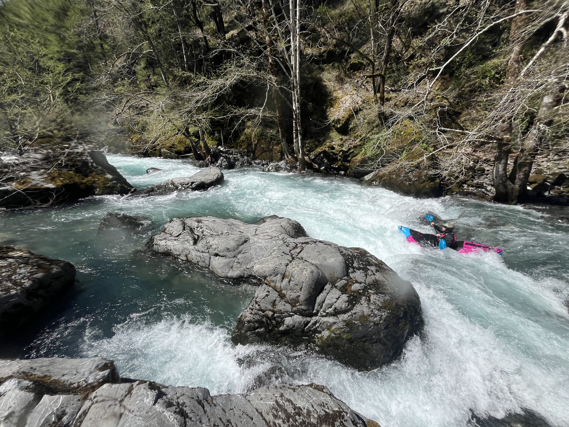 Photo Credit Jacob Cruser
Around where Darling Creek comes in the rapids became a lot more bouldery and much steeper: We did quite a bit of portaging through here, with some nice gems sprinkled in.
 Jacob somewhere on the second half
I pinned again, there was more portaging, and then things tapered off to around 50FPM about a mile about the confluence. We had some final portages and nicer rapids into the Chetco. Both stoke and fatigue were high with another 15 miles of Chetco to go.
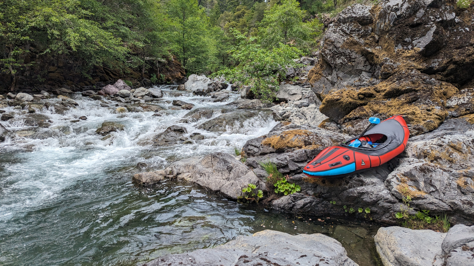
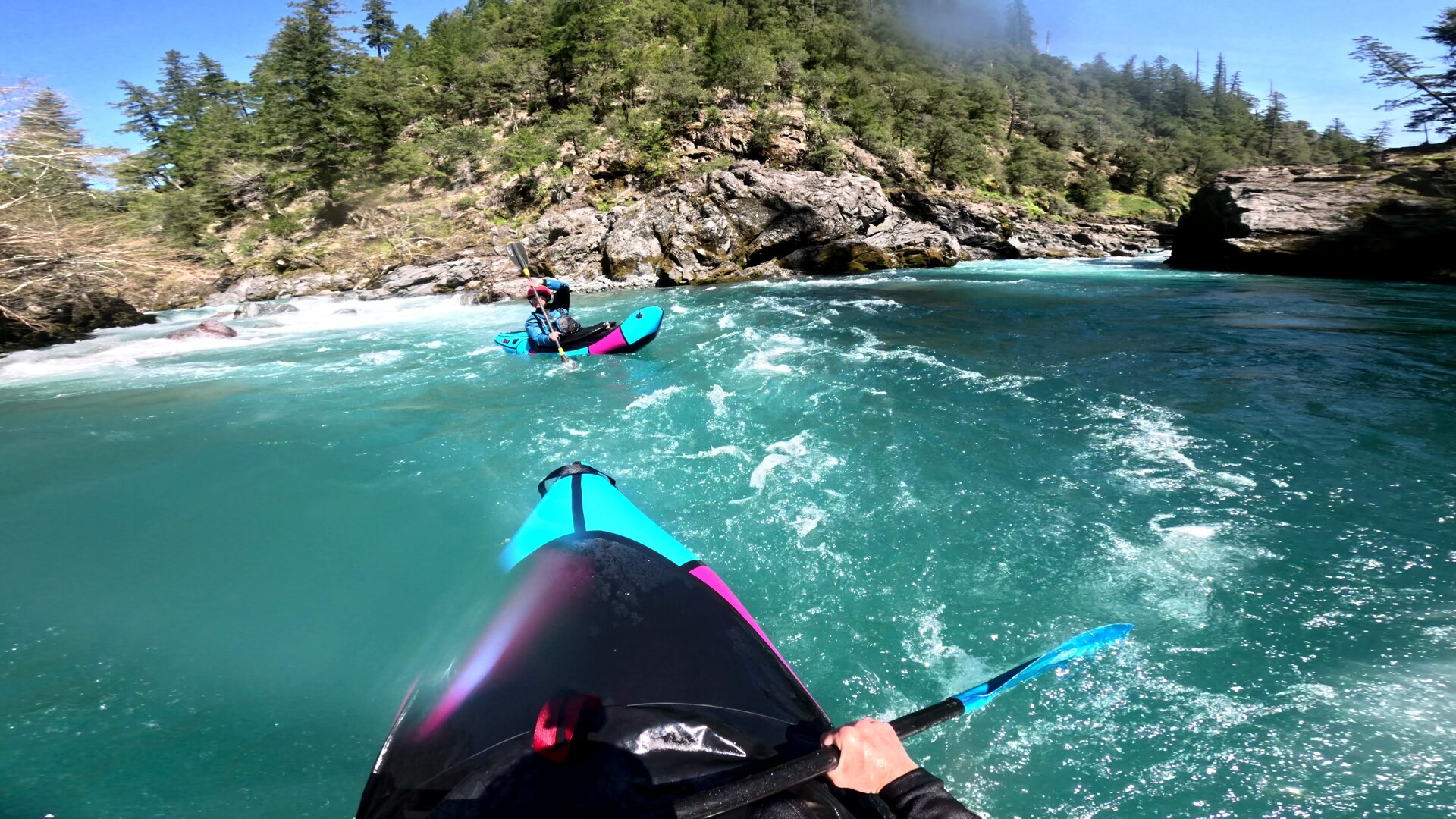 The confluence: Tin Cup on the left, Chetco on the right
We were definitely fading paddling through this section: the hike had really taken it out of us. At one point we were scouting one of the last big drops below Tollman Ranch and I could not remember what path we took to get back to the boats. It was kind of amazing.
We made it back to the car without incident, a day ahead of schedule, and completed the shuttle. I said goodbye to Jacob, drove through Grant’s Pass to eat a bunch of fast food and fell asleep at a rest stop. Goal achieved.
Epilogue
I wouldn’t really recommend this route to anyone: the bushwhack is insane, but the Illinois to Chetco link-up needed to happen. I felt extremely lucky that we were able to make it up. I would recommend that the ambitious hike in on the Kalmiopsis Rim Trail and drop into the headwaters. Preferably with a good amount of water in the Chetco, like 4k+.
There are still mysteries to be solved in there, including “waterfalls” of a dubious nature and quality. The Kalmiopsis Wilderness is a special place, and it rewards those ambitious few willing to dream a little bit.
